
1256 Union St, Marshfield, MA 02050, USA
New England Forestry Foundation: 978-952-6856
https://newenglandforestry.org/explore/explore-our-forests/
Owned By: New England Forestry Foundation
Nelson Memorial Forest in Marshfield is a 180-acre parcel on the North River owned by the New England Forestry Foundation. It features 3 miles of intersecting trails through varied habitats, plus numerous old stone walls. One trail offers views of Cove Creek and the marshes that surround it. Another trail leads down a steep slope to a gorgeous view of the North River and the Union Street Bridge. This property is contiguous with Union Street Woodland and Phillips Farm Preserve.
Also on the property are the remains of a historic packet landing, located directly on the North River. For 200 years beginning in the 1600’s, packet ships sailed up and down the North River, buying and selling goods. Built of logs and stone, can be viewed both from the land and from the water, at most tides. Please do not disturb this historical artifact.
Hunting is not allowed on any of Marshfield’s conservation properties. Conservation lands surround Nelson Memorial Forest, which is owned by the New England Forestry Foundation.
Features
Taken together, Nelson Forest, Union Street Woodland, and the adjacent Phillips Farm Preserve provide more than 200 acres of open space and wildlife habitat along the North River in Marshfield. The greenbelt continues across Union Street, with Cornhill Woodland and the John Little Conservation Area. Three additional adjacent properties — Tilden Farm, Cove Creek Nature Area, and Oak Street Woodland — provide another 75 acres of contiguous habitat and open space. Please note that these latter properties (Tilden, Cove and Oak) are preserved as wildlife habitat and not presently accessible to the public.
The remnants of a historic packet landing stand on the property, at the edge of the North River. In the book Pembroke: Ancient Trails to the 21st Century, Joseph Chetwynd describes packet landing construction as follows. “The landings were most likely built of crib-logs, back-filled with rocks and topped with gravel, with dead-man posts set up as bollards for tying up the vessels. These landings ran parallel to the shoreline and projected into the stream as little as was necessary so as not to impede the flow of traffic in the stream. They may also have incorporated vertical sheathing on the facing to act as fenders for the boats as they lay against the bulkhead.”
Packet ship lines were established prior to 1670, and thrived until railroads came to the South Shore in the mid-to-late 1800s. Over time, White’s Ferry, Little’s Bridge, Union Bridge, Hobart’s Landing, Foster’s Landing, Job’s Landing, Brick-Kiln Yard, and the North River Bridge (Washington Street Bridge) in Hanover became regular stops. Farmers would meet the packet ship and barter home-grown products for goods from China and the Mediterranean, such as coffee, sugar and spices. Packet pilots also purchased wood, fish, pot iron, and charcoal from locals, and sold them lumber and ship supplies.
Cove Creek, which flows along one edge of the property, is also known as Rogers Creek. John Rogers of Scituate established a 100-acre farm on the land at Nelson Forest in 1649. By 1660 he had built a house, which his descendants continued to inhabit until 1854. The hill on which the house stood was — for a time — is known as Moses Rogers Hill, named for one of the last of the Rogers Family to live there. The pond at the bottom of the hill is known as Rogers Pond. Rogers/Cove Creek was home to several enterprises. John Rogers Jr. operated a tannery in 1771 on the brook. Later it was run by the Waterman family (through the 1820s), and then John Sprague converted it to a rivet factory. It was probably Sprague who dammed the creek to create the pond. Later the factory produced boxes, shingles, and toy buckets.
In 1872, Henry W. Nelson purchased the Rogers Farm, which by then had doubled in size to 200 acres. Nelson’s establishment was large: it raised horses, Holstein cattle, pigs, and chickens, and employed 50 full time workers. Large greenhouses facilitated the cultivation of a wide variety of crops, including the famous Marshall strawberry, plus there was a large apple orchard overlooking the river. For irrigation, Nelson installed a system to pump water up from the brook (look for its remains on the Pasture Road trail).
In time the property was passed down to Katharine Dorothea Nelson, who in 1958 donated much of it to the New England Forestry Foundation. In 1977, her heirs — Margaret H. Milholland, Anne Felton Spencer, Hugh Kingsbury Tyson, and Penelope L. Adams — donated an adjoining parcel. Note: Much of this historic information was gleaned from Marshfield, a Town Of Villages, 1640-1990 by Cynthia Hagar Krusell.
This land is within the region of the Massachusett (or Massachuseuk). To learn more about local Native American tribes, we encourage you to interact with their members. The Massachusett tribe at Ponkapoag and the Mattakeeset band of the Massachusett share information on their websites.
Trail Description
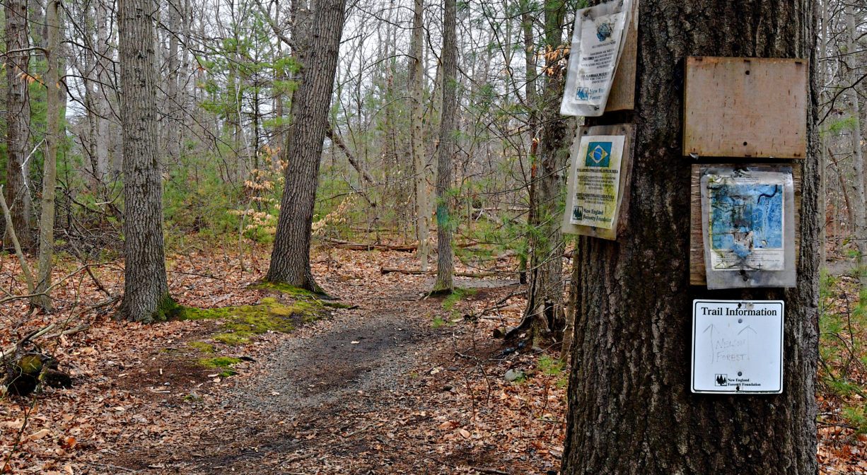
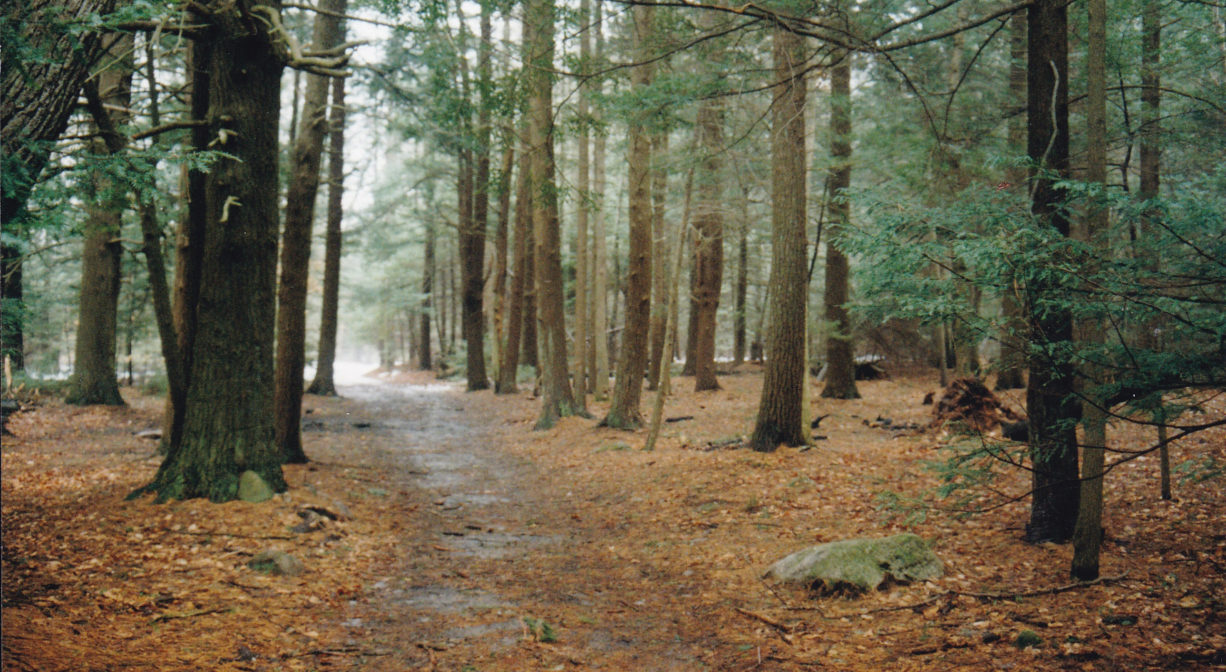
There are about 3 miles of interconnecting trails here. Many of them are wide cart paths and unpaved logging roads, but there are also some narrower footpaths. Some trails are well-marked. Others could use some tidying up. The New England Forestry Foundation occasionally harvests trees from Nelson Forest.
The property extends for a considerable distance along the side of a hill. Depending on where you enter and exit, your hike could involve a long uphill climb. Although the trails within the forest are often wide, the access trails from the parking areas are not, so maneuvering a stroller into Nelson Forest is not recommended!
The best access to Nelson Forest is through the Union Street Woodland. Portions of this trail are narrow, but keep going and you’ll find flatter, wider paths ahead. Entering from the Union Street Woodland spur trail, you will come to a T intersection. This is the River Pasture Road. Head downhill, and after passing at least 2 old stone walls, look for a narrower trail to the left. This leads down a steep incline to an overlook on the banks of the North River. If you walk out to the river’s edge and look downstream, you should be able to see what remains of the packet landing.
The River Pasture Road leads to the Orchard Loop, which passes through the part of the property where the Rogers Family’s apple orchard stood. The Orchard Loop will bring you back around to the River Pasture Road (via Quarry Road), or you can explore the property further by turning left again onto the Belt Line Road. This links you with the trail network in the eastern half of the property, including the Wolf, Cranberry, Cove Brook and Rock Road trails. Along the way, you’ll be treated to several fine views of the salt marsh and the North River, as well as Cove Creek.
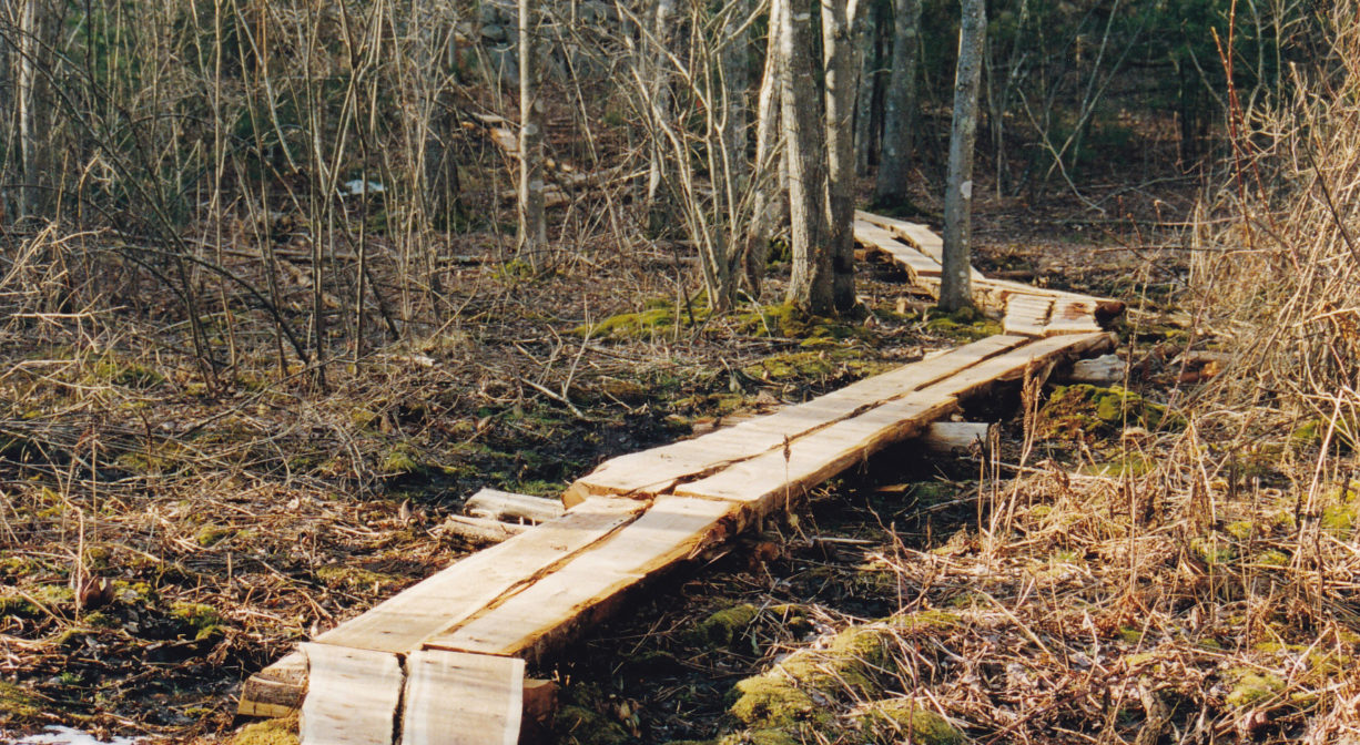
Another entrance is located at the base of the hill on Highland Street, across from Rogers Pond. Here you can follow the Pasture Road Trail. After passing through some wetlands (on rustic boardwalks), you will begin to climb uphill through the woods. Watch for an old cistern at the side of the trail. The view of Cove Creek from this spot alone is worth the trip! The Pasture Road trail links to the main trail system where Wolf Road and Rock Road come together.
Habitats and Wildlife
Nelson Memorial Forest is full of wildlife, ranging from white-tailed deer to the tiny 4-toed salamander that can be found near the small creeks. Look for grey squirrels collecting acorns, and raccoons foraging by the river’s edge. Perhaps you’ll see a long-billed marsh wren in the marsh areas, or osprey along Cove Creek. Much of the forest is pine and oak, with some holly, birch, and ash here and there, along with witch hazel and sweet pepper bush. Near the Highland Street trailhead, there is a grove of maple trees that are often tapped for syrup in the springtime. Farther into the property is a lovely grove of beech trees. Near the Union Street Woodland entrance is a small grove of hemlock.
This property is located on the North River one of its many tributaries, Cove Creek. Approximately 10 miles in length, the North River begins at the confluence of the Indian Head River (Hanover) and Herring Brook (Pembroke). From there it flows through the towns of Hanover, Pembroke, Marshfield, Norwell, and Scituate. It empties into the Atlantic Ocean between Third and Fourth Cliffs, draining approximately 59,000 acres along the way.


Historic Site: No
Park: No
Beach: No
Boat Launch: No
Lifeguards: No
Size: 180 acres
Hours: Dawn to Dusk
Parking: Park at Union Street Woodland, which is located at 1253 Union Street, just before Hunter Drive while driving north. Additional parking (2 cars) on Highland Street, at the intersection with Spring Street, across from Rogers Pond.
Cost: Free
Trail Difficulty: Easy, Medium
Facilities:
Geocache location, benches.
Dogs: Dogs must remain on leash. Always clean up after your dog!
Boat Ramp: No
ADA Access: No
Scenic Views: Yes
Waterbody/Watershed: Cove Creek (North River watershed)