
Town of Duxbury: (781) 934-1100
Owned By: Town of Duxbury
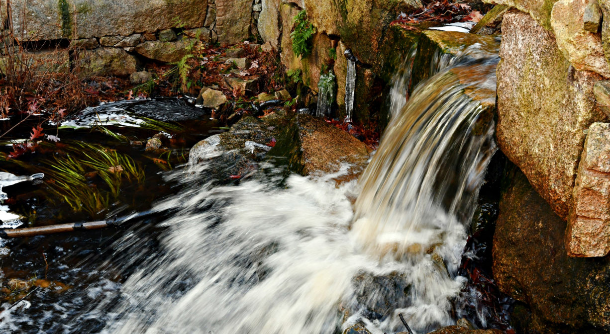
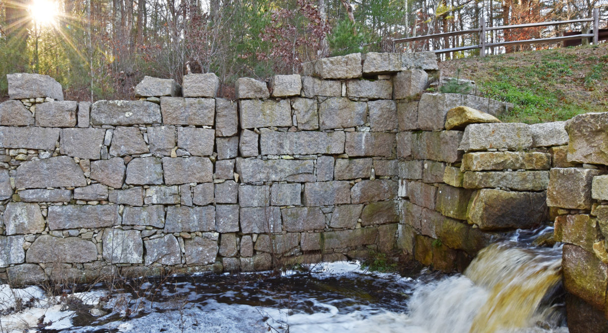
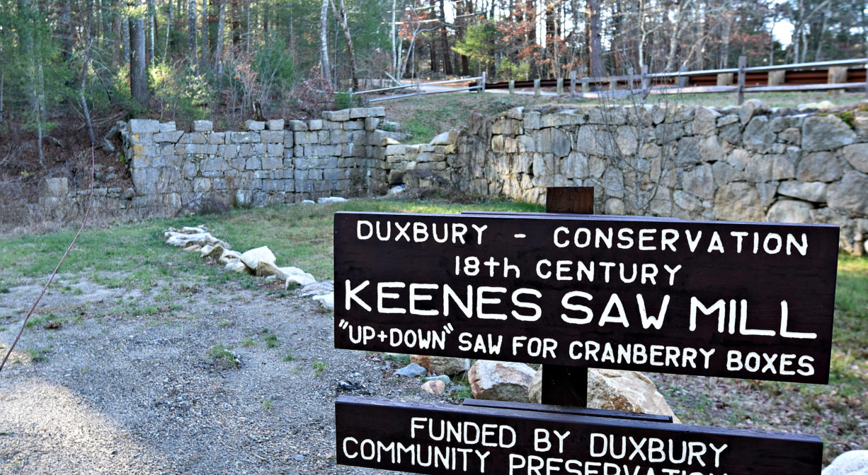
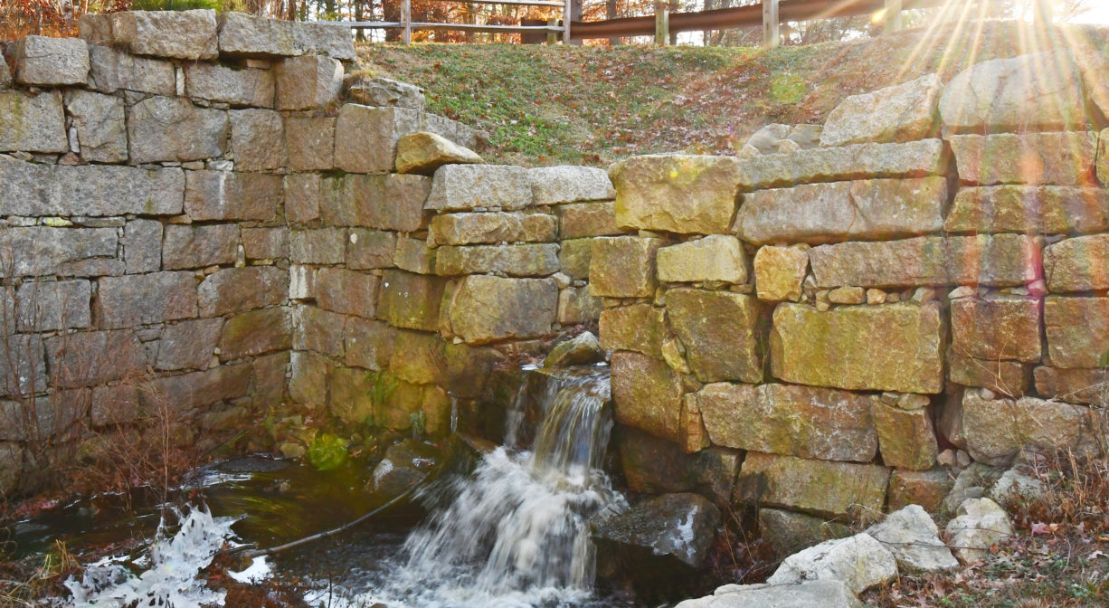
Keene’s Sawmill is a historic site in Duxbury, MA. In the 18th century, a sawmill produced boxes for cranberries here. Portions of the granite structure remain in place. Keene’s Brook flows through the site, between Keene and Temple Streets.
Features
Josiah Keene acquired the land surrounding Keene’s Brook, in the Ashdod neighborhood of Duxbury, around 1680. A grist mill was established on site in the mid-1700’s, and then in the 1800’s a sawmill was erected here to supply boxes and barrels for Duxbury’s shipbuilding industry. Later, the mill produced boxes for the cranberry industry. The mill dam created Keene’s Mill Pond, just upstream, on the other side of Keene Street.
Prior to European contact, the Mattakeeset band of the Massachuseuk (or Massachusett) Native American tribe lived for thousands of years in the North River watershed. Their village included most of today’s Pembroke and Hanson. Meanwhile the Patuxet band of the Wampanoag tribe inhabited the Jones River watershed, and the area now known as Kingston, Plymouth and Duxbury. This property lies within the upper portion of the South River watershed — right between those two territories. It’s possible that both tribes utilized the area.
To learn more about local Native American tribes, we encourage you to interact with their members. The Mashpee Wampanoag, the Herring Pond Wampanoag, the Mattakeeset band of the Massachusett, and the Massachusett tribe at Ponkapoag all share information on their websites.
Trail Description
This particular site doesn’t have trails, but just across the street you can explore the John Rubin Path, a 1-mile loop through the woods with views of the South River and its surrounding wetlands. For more information, see our listing for Camp Wing Conservation Area.
Habitats and Wildlife
Keene’s Brook finds its source in the wetlands between Congress, Taylor, Union and Keene streets. It flows through today’s Camp Wing property and into Keene’s Sawmill Pond. Just downstream of the sawmill site, it flows into the South River.
The South River originates deep in Duxbury. Its source is in the Round Pond area, and from there it winds unobtrusively through the woods for several miles. Although one can view it from Route 3, and also from both the South River Bog and the Camp Wing Conservation Area, it remains a narrow and mostly un-navigable stream until just below Veterans Memorial Park. From there it flows through South River Park, behind the playground of South River School, and under the Willow Street and Francis Keville Bridges. Wider at that point, and navigable at most tides, its course winds through the marshes as it runs parallel to Route 139, all the way to Rexhame. From there the river turns northward. It flows for 3 miles between Humarock and the mainland to Fourth Cliff, where it joins the North River at its outlet to the sea.
Historic Site: Yes
Park: No
Beach: No
Boat Launch: No
Lifeguards: No
Size: 0.25 acre
Hours: Dawn to Dusk
Parking: Limited on-site parking at 25 Myrtle Street, Duxbury.
Cost: Free
Trail Difficulty: Easy
Dogs: Dogs must remain on leash or under control at all times. Please clean up after your pet!
Boat Ramp: No
ADA Access: No
Scenic Views: Yes
Waterbody/Watershed: Keene's Brook (South River watershed)