
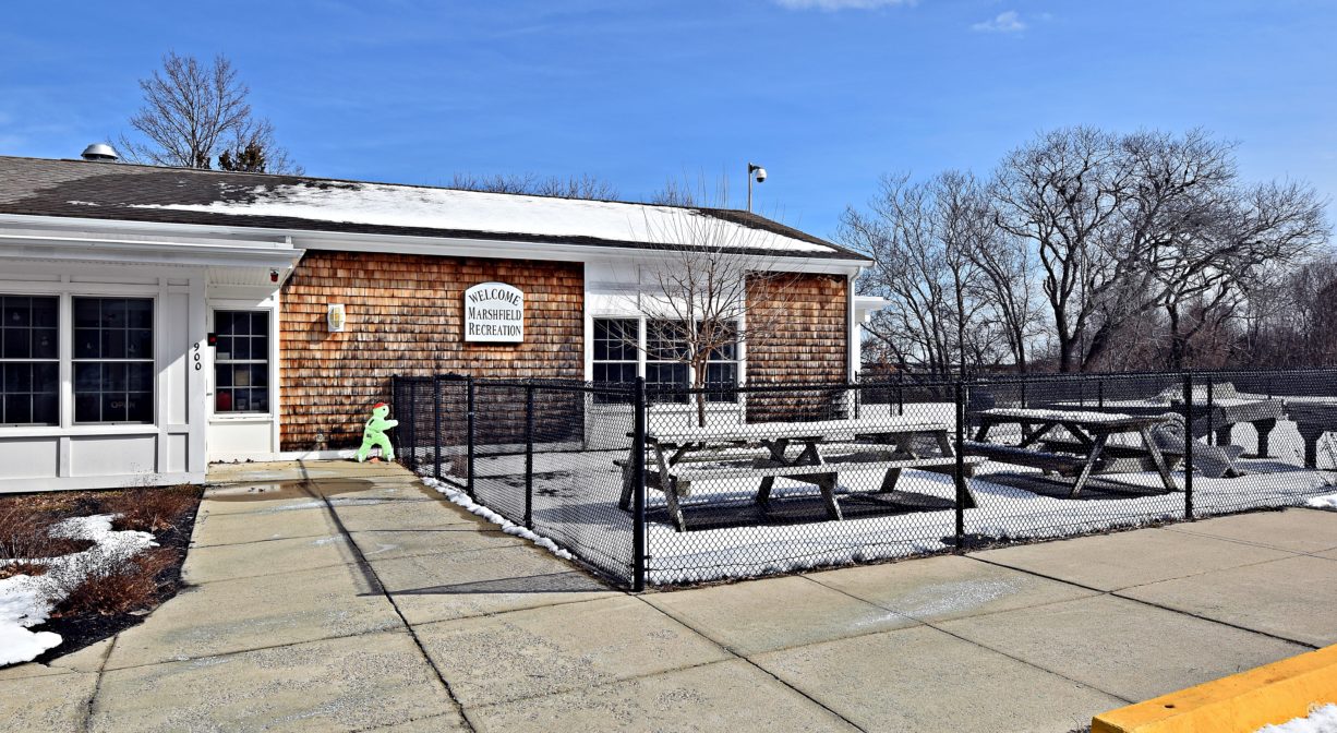
Marshfield Recreation Department, 900 Ferry St, Marshfield, MA 02050, USA
Marshfield Recreation: (781) 834-5543
https://www.marshfield-ma.gov/recreation-department
Owned By: Town of Marshfield
Formerly a Coast Guard Communications Center, Coast Guard Hill in Marshfield is now the home of the Marshfield Recreation Department. The 40-acre property features a popular sledding hill, walking trails, volleyball, basketball and horseshoe courts, a playground and a picnic area. There is also a 20-plot community garden on site, featuring 20 small (4’x8′) raised bed garden plots.
Hunting is not allowed at Coast Guard Hill, nor at any of Marshfield’s other conservation properties.
Features
In 1943, the United States Coast Guard established a communication center on this property, to transmit weather information and keep track of shipping along the Eastern Seaboard. You might be picturing this as a utilitarian government building, but it was actually housed within in a stately home constructed in 1901 by Dr. Harold Hunt. Now privately owned, the building stands at the top of what’s now known as Coast Guard Hill, where there is a sweeping view of the South River and the ocean beyond. At one time, 50 guardsmen lived in the home. Around 1990 the house was sold and operations were moved to a smaller facility at the foot of the hill. For many years after the war, the communications center’s function was to transmit weather maps and shipping information, and to maintain radio contact with other stations around the western hemisphere.
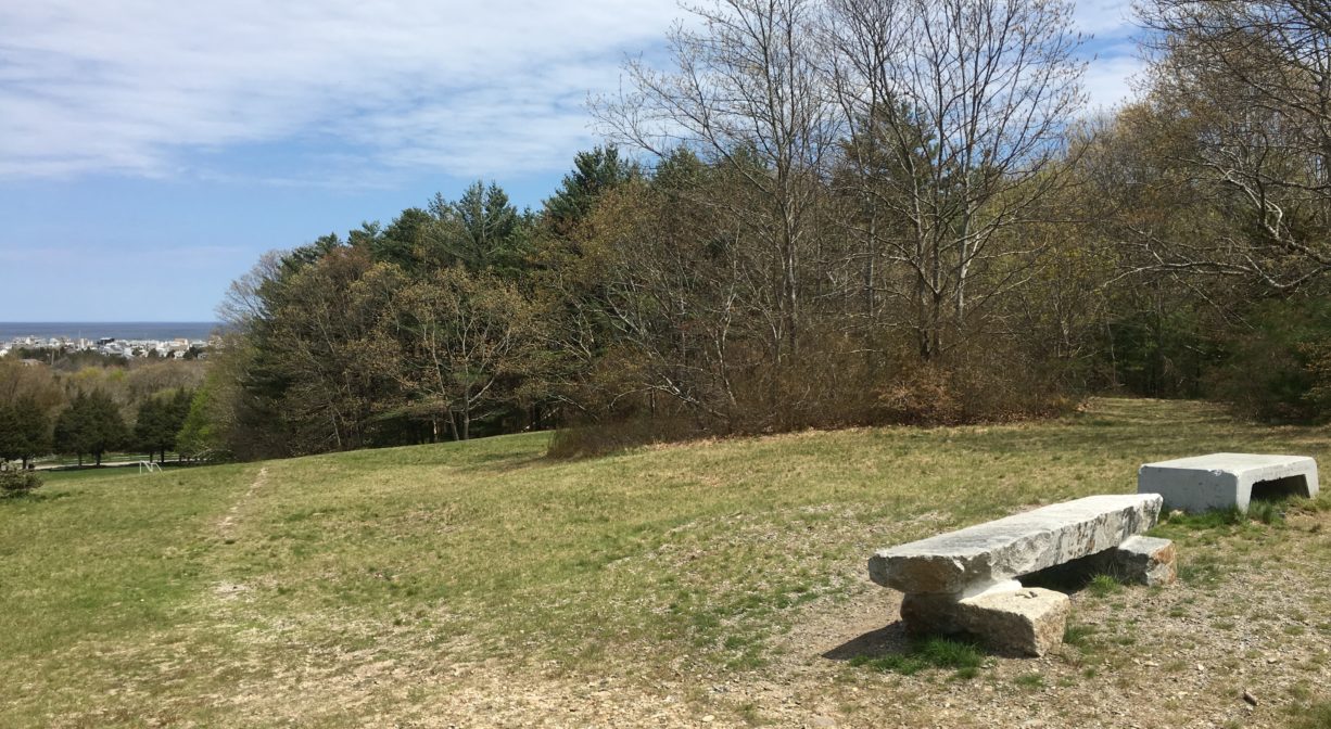
In 1999, the federal government ceded ownership of Coast Guard Hill to the Town of Marshfield. In 2004, Marshfield erected a large granite memorial to recognize those who served there, as well as two granite benches at the top of the hill. After some renovations and site development, the Marshfield Recreation Department’s headquarters were moved to Coast Guard Hill.
The Community Garden plots on site are small, and most suitable for single people, kitchen herb gardens, or more beginner gardeners. For larger plots, consider the Community Garden at Mounces Meadow. The Marshfield Agricultural Commission’s website offers additional information and an application. All gardens must be maintained with organic practices and materials.
This land is within the region of the Massachusett (or Massachuseuk). To learn more about local Native American tribes, we encourage you to interact with their members. The Massachusett tribe at Ponkapoag and the Mattakeeset band of the Massachusett share information on their websites.
Trail Description
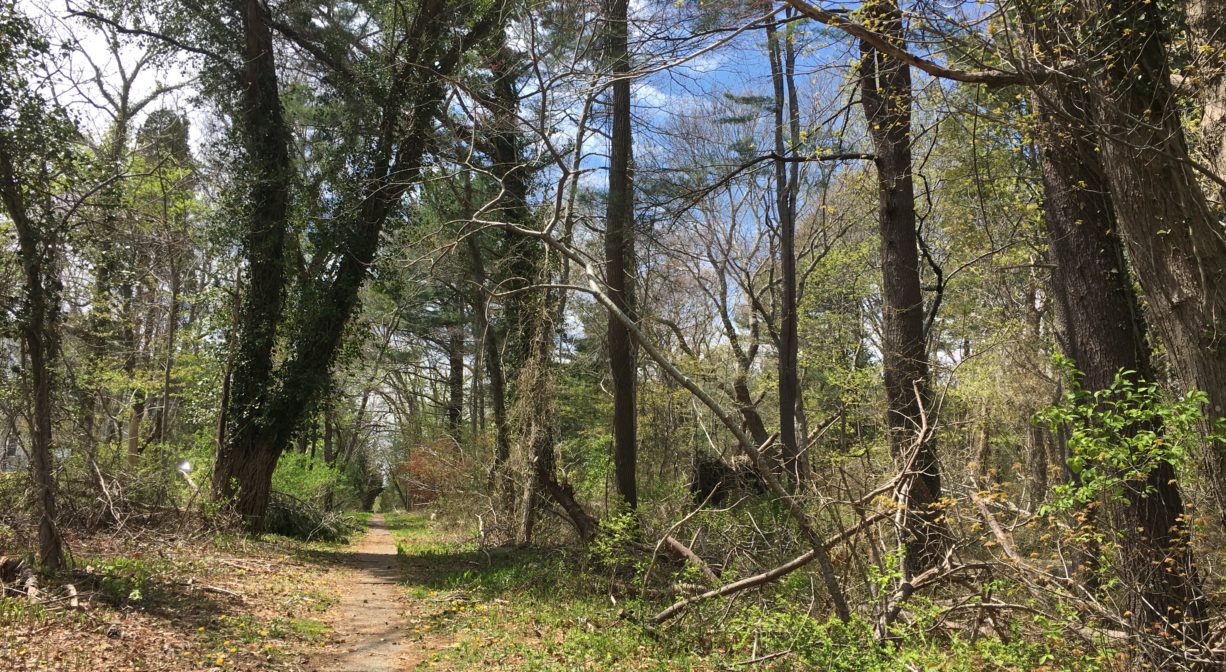
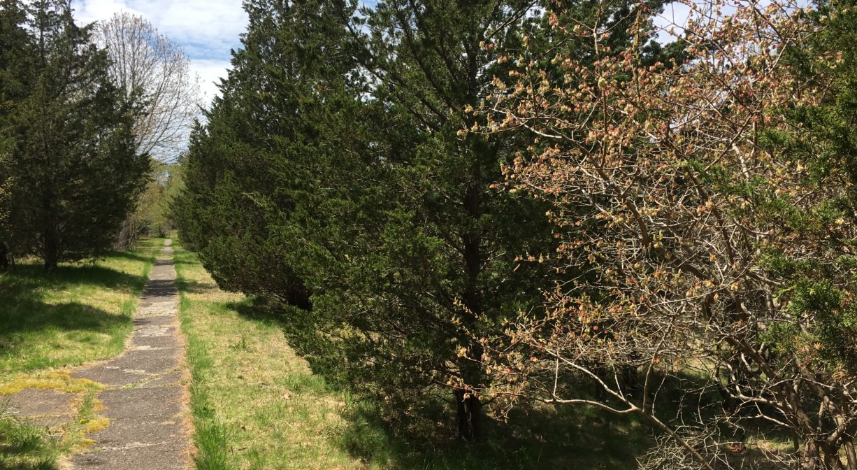
A short (0.3 mile) trail leads to the top of the hill for a stunning view of Humarock, Rexhame, the South River, and the ocean. It begins directly across from the Marshfield Recreation Headquarters building and heads uphill. There are stone stairs in the steeper sections. Much of the trail is paved.
Habitats and Wildlife
The trail leads through a mixed forest that includes cedar, pine, oak, pitch pine, maple, cherry, birch, and black walnut, along with sumac, bayberry. Turn around as you climb the hill and you’ll see the South River in the distance. The top of the hill, as well as the slope that’s home to the sledding hill, is grass.
Clapp Creek flows through the property and empties into the South River at the Marshfield/Scituate (Humarock) town line. The South River originates deep in Duxbury. Its source is in the Round Pond area, and from there it winds unobtrusively through the woods for several miles. Although one can view it from Route 3, and also from both the South River Bog and the Camp Wing Conservation Area, it remains a narrow and mostly un-navigable stream until just below Veterans Memorial Park. From there it flows through South River Park, behind the playground of South River School, and under the Willow Street and Francis Keville Bridges. Wider at that point, and navigable at most tides, its course winds through the marshes as it runs parallel to Route 139, all the way to Rexhame. From there the river turns northward. It flows for 3 miles between Humarock and the mainland to Fourth Cliff, where it joins the North River at its outlet to the sea.


Historic Site: No
Park: Yes
Beach: No
Boat Launch: No
Lifeguards: No
Size: 40 acres
Hours: Dawn to Dusk
Parking: Ample on-site parking at 900 Ferry Street.
Cost: Free
Trail Difficulty: Easy, Medium
Facilities:
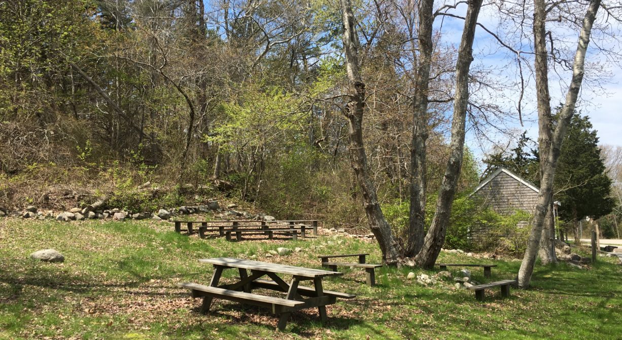
Volleyball and basketball courts, horseshoe pits, sledding hill, playground, picnic area, benches, walking trail, community garden plots. Porta-potty on site, near soccer field. Multiple geocache locations, including this one.
Dogs: Dogs must remain on leash. Please clean up after your pet!
Boat Ramp: No
ADA Access: Portions of the property are ADA accessible, but the trail is not.
Scenic Views: Yes
Waterbody/Watershed: Clapp Creek (South River watershed)