
145 Pudding Hill Ln, Marshfield, MA 02050, USA
https://wildlandstrust.org/pudding-hill-reservation
Owned By: Wildlands Trust
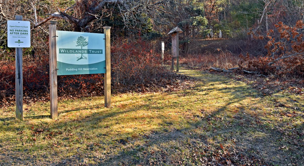
Pudding Hill Reservation is a 37-acre Wildlands Trust property, located on Chandler’s Pond and the South River in Marshfield. It features 1.6 miles of trails. The pond owes its existence to a dam built for milling operations in colonial times. Enjoy views at the pond-side meadow and on the trail that leads up and down a forested hill.
Watch this space: the now-obsolete dam on the South River at Chandler’s Pond is being studied for removal. Removing the dam will improve water quality, restore fish passage and wildlife habitat, and eliminate the risk of property damage resulting from a dam breach or failure.
For up-to-date information and real time trail conditions, visit wildlandstrust.org/trails
Hunting is not allowed on this property.
FISHING ADVISORY: It’s important to know that some of our freshwater fisheries are contaminated with mercury, PFAS and/or other concerning substances. The Massachusetts Department of Public Health maintains an online database with up-to-date advisories regarding fish consumption, sorted by location. We recommend you consult this valuable resource when planning a fishing excursion.
Features
The information below was gleaned from Marshfield: A Town of Villages 1640-1990 by Cynthia Hagar Krusell and Betty Magoun Bates.
Samuel Baker was one of the founders of the Town of Marshfield. He received 30 acres from the town in 1659 at Mount Scargoe (now Mount Skirgo), and later acquired adjacent lands owned by John Adams and James Pitney. As the property passed down through the family, it continued to grow, eventually extending all the way to Moraine Street. The land now known as Pudding Hill Reservation was part of Baker’s domain.
The Bakers operated a grist mill on the South River at Baker’s Pond (now Chandler’s Pond). This was established around 1706. A second grist mill was added in 1771. In 1810, the Marshfield Cotton and Woolen Manufacturing Company established a cotton mill in a new building on the site of one of the grist mills. This was known as the Upper Mill, as the company also had a mill downstream at today’s Veterans Memorial Park, known as the Lower Mill. The Upper Mill closed in 1835. By the middle of the 19th century, within this area there was also a factory school, a dye house, a blacksmith shop, and boarding houses for the mill workers.
From 1847-1857 Elijah Ames ran a woodworking shop on the site, producing boxes, trunks, barrels and coffins. Later Gilbert West established a grist and sawmill here and remained in business until the 1920s. Later still, Simeon Bartlett (Bart) Chandler offered a variety of services at the site, including sawing, planing, carriage building, blacksmithing, and the manufacture of lobster pots and shoe racks. His mill burned down in 1936.
The Chandler’s Pond area took on a new life in the years that followed, most notably becoming home to a summer camp for boys known as Camp Millbrook (1938-1985). The Boston Celtics pro basketball team hosted annual clinics there. Pudding Hill Reservation itself was created thanks to a gift of land from Elizabeth Bradford in 1991.
This land is within the region of the Massachusett (or Massachuseuk). To learn more about local Native American tribes, we encourage you to interact with their members. The Massachusett tribe at Ponkapoag and the Mattakeeset band of the Massachusett share information on their websites.
Trail Description
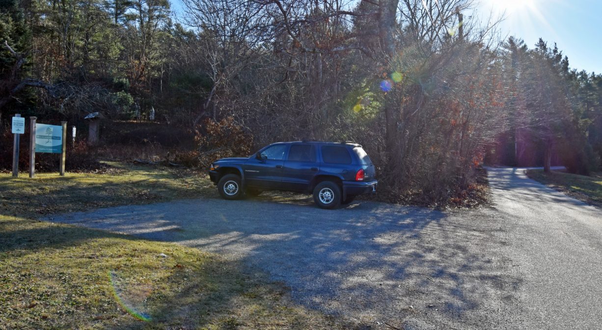
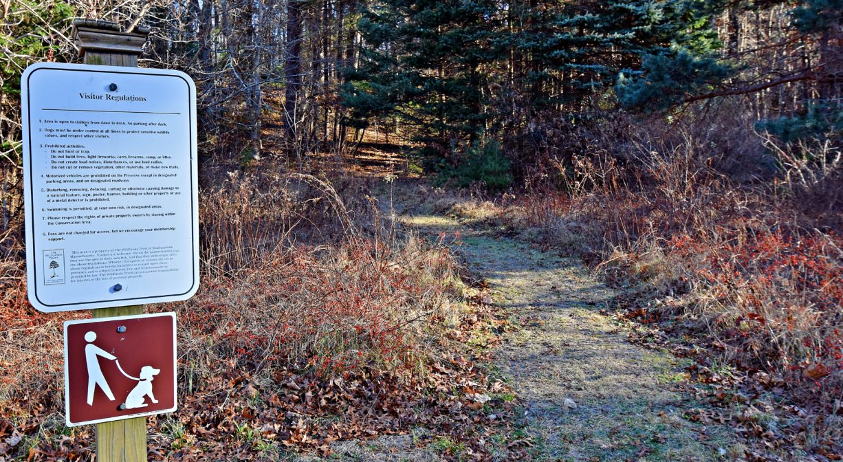
Look for the trailhead near the preserve sign, on the left side of the road. A path leads up the hillside from Pudding Hill Lane. This is a relatively steep climb — at least for our region! Arriving at a crossroads, there are options. The longer (1.1 mile) trail, to the left, leads over the hill and down to Old Ocean Street before climbing back up the hill. Returning to the top, you’ll be treated to views of Veterans Memorial Park and the South River. From there, the trail continues to the other side of the property, with a loop around a colossal town-owned water tank. There is also a shortcut trail back to the original crossroads. For a shorter walk, go straight at the crossroads, to access the view of the park and river more directly. Or turn right at the crossroads, to take the shorter (0.5 mile) route to the water tank loop. Please bear in mind that there are additional, unmarked trails that connect to this property. We recommend carrying a map!
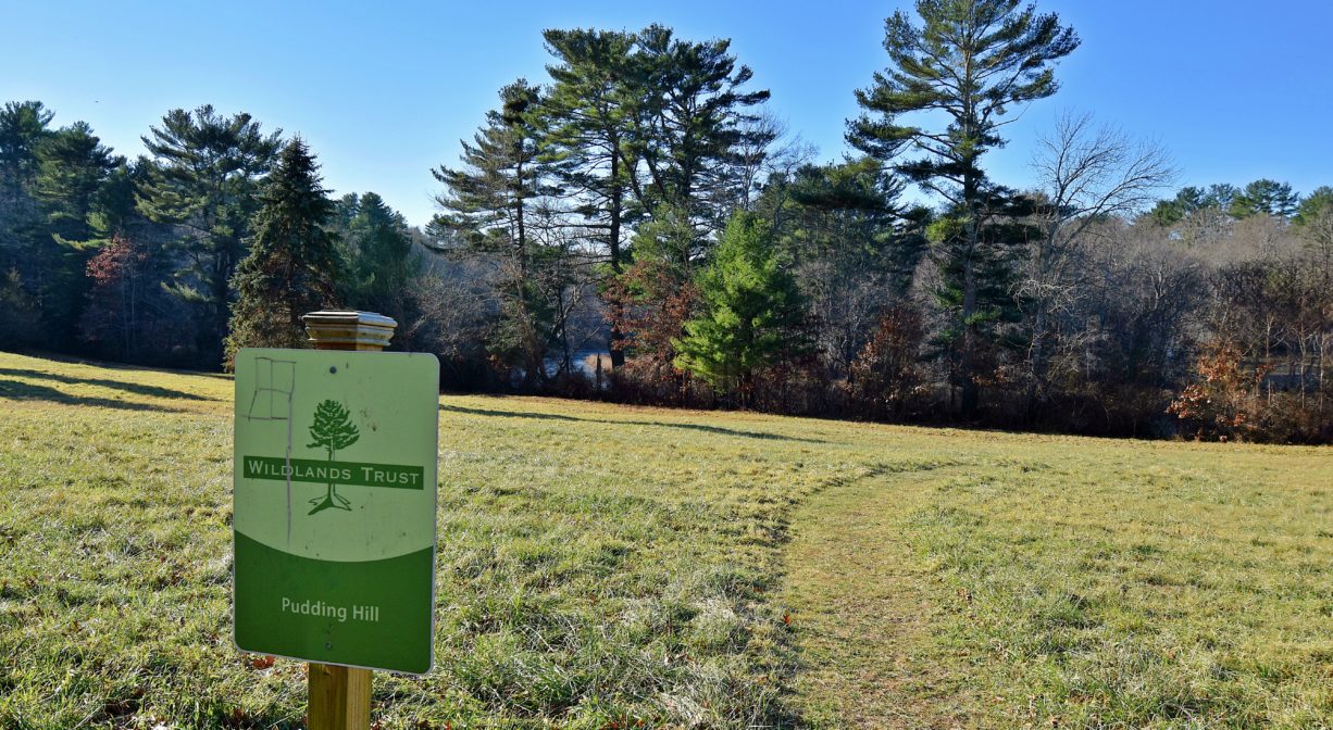
In addition, the property includes a small amount of frontage on Chandler’s Pond. Directly across the road from the preserve sign, look for a trail across the meadow. It ends at the pond, and you can walk a short distance in either direction for additional views. Don’t overlook this part of the preserve — it is a truly lovely spot!
Habitats and Wildlife
The upland forest at Pudding Hill Reservation is dominated by white pine, although there is also some white oak and black oak. In the spring, listen for the trills of the nesting pine warbler and chipping sparrow. In the lowlands closer to the pond and river, red maples are a common sight. Look for herons, belted kingfishers and other waterfowl in the pond, as well as a skunk cabbage, moss, and wildflowers. You may even see a pale green orchid!
The South River flows through this property, passing through Chandler’s Pond, and dividing into two streams at its northern end. One stem of the river exits at the northwest corner of the pond, while another exits at the northeast corner. The two streams flow together again a short distance away, after passing under Route 139 (Plain Street). The obsolete industrial dam on Chandler’s Pond is being studied for removal.
The South River originates deep in Duxbury. Its source is in the Round Pond area, and from there it winds unobtrusively through the woods for several miles. Although one can view it from Route 3, and also from both the South River Bog and the Camp Wing Conservation Area, it remains a narrow and mostly un-navigable stream until just below Veterans Memorial Park. From there it flows through South River Park, behind the playground of South River School, and under the Willow Street and Francis Keville Bridges. Wider at that point, and navigable at most tides, its course winds through the marshes as it runs parallel to Route 139, all the way to Rexhame. From there the river turns northward. It flows for 3 miles between Humarock and the mainland to Fourth Cliff, where it joins the North River at its outlet to the sea.


Historic Site: No
Park: No
Beach: No
Boat Launch: No
Lifeguards: No
Size: 37 acres
Hours: Dawn to Dusk
Parking: Limited on-site parking at 145 Pudding Hill Lane, Marshfield.
Cost: Free
Trail Difficulty: Easy, Medium
Facilities:
Bench, informational kiosk.
Dogs: Dogs must remain on leash. Always clean up after your dog!
Boat Ramp: No
ADA Access: No
Scenic Views: Yes
Waterbody/Watershed: Chandler's Pond (South River watershed)