
677 Temple St, Duxbury, MA 02332, USA
Town of Duxbury: (781) 934-1100
Owned By: Town of Duxbury
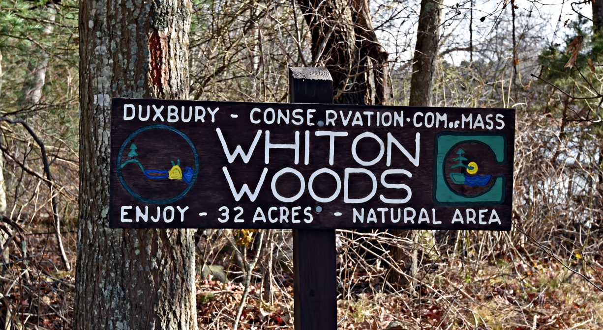
Duxbury’s Whiton Woods is a 37-acre conservation property, located on Temple Street. Next door is Cedar Crest Conservation Area, with another 117 acres of cranberry bogs, woodlands and wetlands. Together, the two properties provide 154 acres of open space with a 2.2-mile network of cart paths and trails with views of Harlow Brook.
Hunting is not allowed on this property.
FISHING ADVISORY: It’s important to know that some of our freshwater fisheries are contaminated with mercury, PFAS and/or other concerning substances. The Massachusetts Department of Public Health maintains an online database with up-to-date advisories regarding fish consumption, sorted by location. We recommend you consult this valuable resource when planning a fishing excursion.
Features
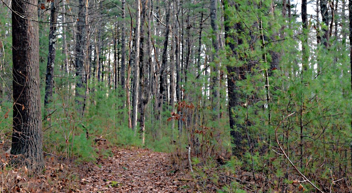
Whiton Woods features old stone walls, bubbling streams, at least one wooden footbridge, large outcroppings of rocks, swampy lowlands, even a vernal pool or two. It was purchased by the Town of Duxbury in 1970 from Harry Hunt Whiton, a long-time summer resident (1950s+).
Cedar Crest was acquired by the Town of Duxbury as conservation land in 2015, the property is located on both sides of Temple Street, directly adjacent to Whiton Woods. (Only the eastern portion is open to the public.)
Whiton Woods and Cedar Crest are located in North Duxbury, a village sometimes known as the Crooked Lane neighborhood, because of the winding road that once connected each of the homes there. Settlers – often the sons and grandsons of Duxbury’s original grantees – began to arrive in 1685. Samuel Delano received an early land grant at Temple Hill, between Enterprise and Temple Streets. Isaac Simmons built a home farther north on Temple, just before Laurel Street, and Joseph Peterson’s farm was even farther north.
Additional settlers arrived in North Duxbury around 1700, with a number of 30-acre grants at the intersections of Lincoln, Franklin and Temple Streets. But even though well-established paths led to other parts of Duxbury, settlers in this area tended to be more connected to Marshfield. They attended church there, and also did their milling, and patronized Marshfield’s shops. North Duxbury once petitioned the General Court to be annexed to Marshfield, but the petition failed.
North Duxbury was largely a farming community. While in other parts of town, dams were constructed on brooks to power mills and factories, the village’s primary waterway, Harlow Brook, remained a quiet stream flowing west through lowlands and eventually into the South River. Some of those swamps and shallow ponds produced bog iron ore, which could be raked up and forged into functional metal.
Prior to European contact, the Mattakeeset band of the Massachuseuk (or Massachusett) Native American tribe lived for thousands of years in the North River watershed. Their village included most of today’s Pembroke and Hanson. Meanwhile the Patuxet band of the Wampanoag tribe inhabited the Jones River watershed, and the area now known as Kingston, Plymouth and Duxbury. This property lies within the upper portion of the South River watershed — right between those two territories. It’s possible that both tribes utilized the area.
To learn more about local Native American tribes, we encourage you to interact with their members. The Mashpee Wampanoag, the Herring Pond Wampanoag, the Mattakeeset band of the Massachusett, and the Massachusett tribe at Ponkapoag all share information on their websites.
Trail Description
A large cedar tree marks the entrance trail to both Whiton Woods and Cedar Crest. Follow the wide, red-blazed entrance trail 0.14 miles. If you turn left at the first intersection, you’ll find yourself on the 1.2-mile loop trail through Whiton Woods, marked in blue. Continue a little farther on the entrance trail, and turn right at either of the 2 remaining intersections. Both of these lead into Cedar Crest, where there is another 1.2 mile loop trail around Harlow Brook Pond and a small cranberry bog (also marked in blue). A few shorter trails within the loop provide some variety. Altogether the trails on this property vary. Some are narrower woodland paths. Others are wide cart paths and bog access roads.
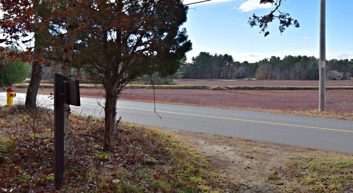
Across Temple Street, additional bogs are part of the property, but they are not open to the public. These working cranberry bogs back right up to Route 3. Dogs are prohibited.
Habitats and Wildlife
There is an abundance of white pine on the property, as well as red and white oak, holly, yellow birch, maple, hickory, tupelo and high bush blueberry. Amusingly, there are very few cedars on the property! Look for wetlands such as white cedar and red maple swamps. And of course, the cranberry bogs! This is also a nesting area for turtles. You may see traces of iron in the shallow waters alongside the trail.
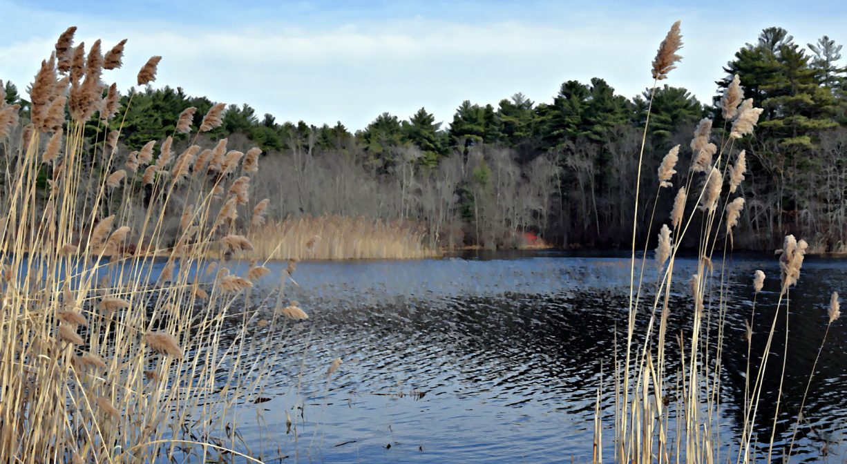
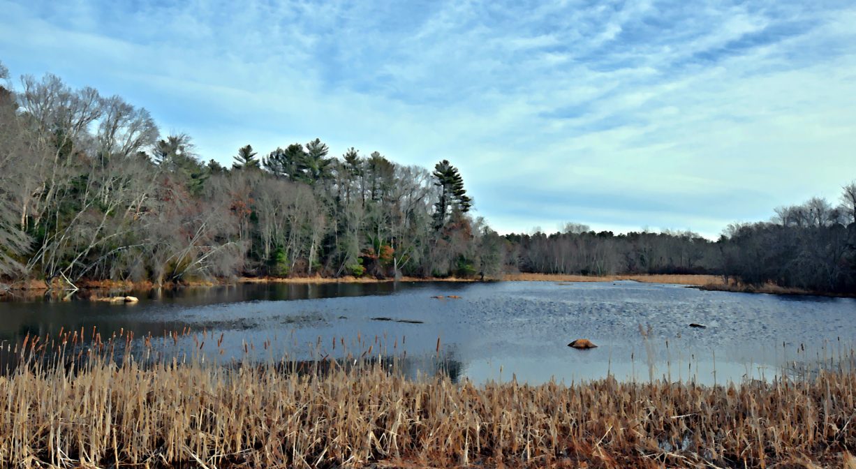
Harlow Brook Pond lies at the center of the eastern side of Cedar Crest. Harlow Brook flows through this property and eventually into the South River.
The South River originates deep in Duxbury. Its source is in the Round Pond area, and from there it winds unobtrusively through the woods for several miles. Although one can view it from Route 3, and also from both the South River Bog and the Camp Wing Conservation Area, it remains a narrow and mostly un-navigable stream until just below Veterans Memorial Park. From there it flows through South River Park, behind the playground of South River School, and under the Willow Street and Francis Keville Bridges. Wider at that point, and navigable at most tides, its course winds through the marshes as it runs parallel to Route 139, all the way to Rexhame. From there the river turns northward. It flows for 3 miles between Humarock and the mainland to Fourth Cliff, where it joins the North River at its outlet to the sea.


Historic Site: No
Park: No
Beach: No
Boat Launch: No
Lifeguards: No
Size: 154 acres
Hours: Dawn to Dusk
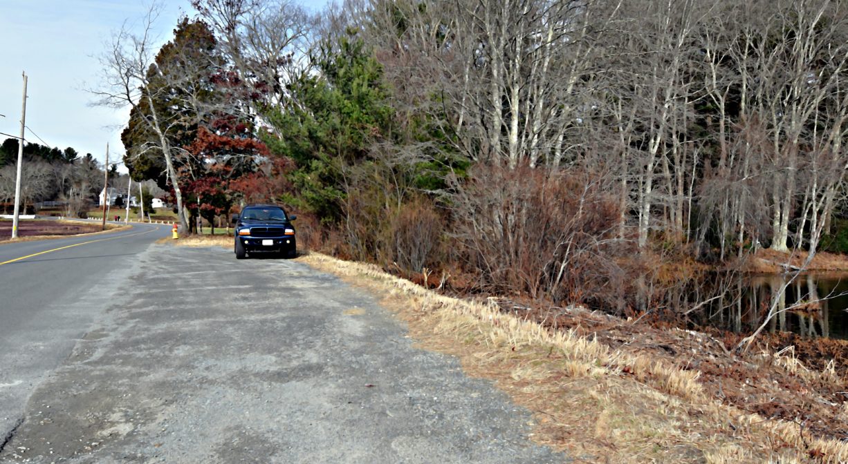
Parking: A roadside pull-off at 677 Temple Street offers parking for 3-4 cars.
Cost: Free
Trail Difficulty: Easy
Dogs: This location is an active farm. Dogs are permitted on the trails, but they are not allowed in the bogs at any time. All dogs shall be effectively restrained and controlled by a chain or leash, or otherwise under the immediate and effective control of a handler, or confined to a motor vehicle. Each person who owns, possesses or controls a dog shall remove and properly dispose of any feces left by his/her dog. For current rules see: https://www.town.duxbury.ma.us/animal-control
Boat Ramp: No
ADA Access: No
Scenic Views: Yes
Waterbody/Watershed: Harlow Brook (South River watershed)