
214 Plain St, Marshfield, MA 02050, USA
Marshfield Conservation: 781-834-5573
Owned By: Town of Marshfield
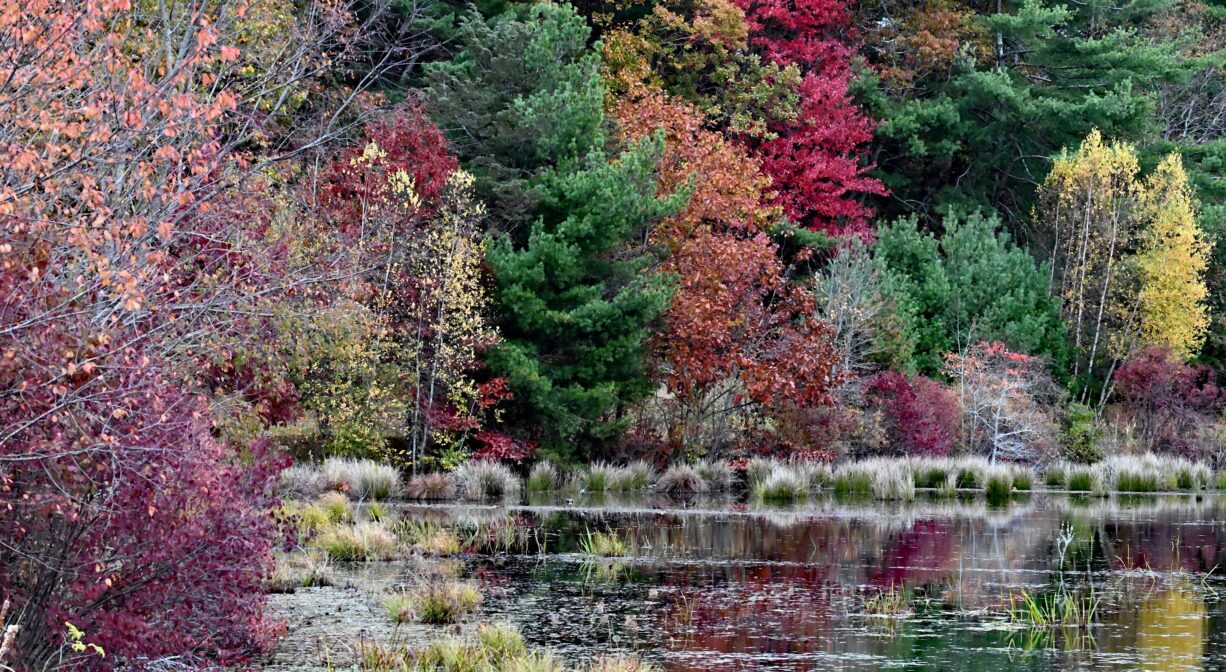
Marshfield’s Ellis Nature Sanctuary features 27 acres of conservation land with 1/2 mile of trails around a former cranberry bog, and streams that flow into the South River. The pond may be suitable for ice skating, in season.
Hunting is not allowed at Ellis Nature Sanctuary, or at any of Marshfield’s other conservation properties.
FISHING ADVISORY: It’s important to know that some of our freshwater fisheries are contaminated with mercury, PFAS and/or other concerning substances. The Massachusetts Department of Public Health maintains an online database with up-to-date advisories regarding fish consumption, sorted by location. We recommend you consult this valuable resource when planning a fishing excursion.
Features
In Marshfield’s Colonial days, the land now known as the Ellis Nature Sanctuary was part of Samuel Baker’s domain. Baker was one of the founders of the Town of Marshfield. He was granted 30 acres in 1659 at Mount Scargoe (now Mount Skirgo), and later acquired adjacent lands owned by John Adams and James Pitney. As the property passed down through the family, it continued to grow, eventually extending all the way to Moraine Street.
The Bakers operated a grist mill on the South River at Baker’s Pond (now Chandler’s Pond, which you can view at Pudding Hill Reservation). This was established around 1706. A second grist mill was added in 1771. In 1810, the Marshfield Cotton and Woolen Manufacturing Company established a cotton mill in a new building on the site of one of the grist mills. This was known as the Upper Mill, as the company also had a mill downstream at today’s Veterans Memorial Park, known as the Lower Mill.
David P. Strange acquired the Ellis property in the early 20th century, and set up orchards there. He established his family’s farm nearby on Cross Street. Josephine Strange, the daughter of David, married Benjamin W. Ellis. Around 1938, they established their cranberry business — 4.5 acres of bogs. Their son David carried on the family business as the Old Mount Skirgo Cranberry Corporation. The Ellis Family sold the property to the Town of Marshfield in 2006, to be used as conservation land.
This land is within the region of the Massachusett (or Massachuseuk) and Wampanoag Native American tribes. To learn more about local tribes, we encourage you to interact with their members. The Mattakeeset band of the Massachusett, the Massachusett tribe at Ponkapoag, the Mashpee Wampanoag, and the Herring Pond Wampanoag also share information on their websites.
Trail Description
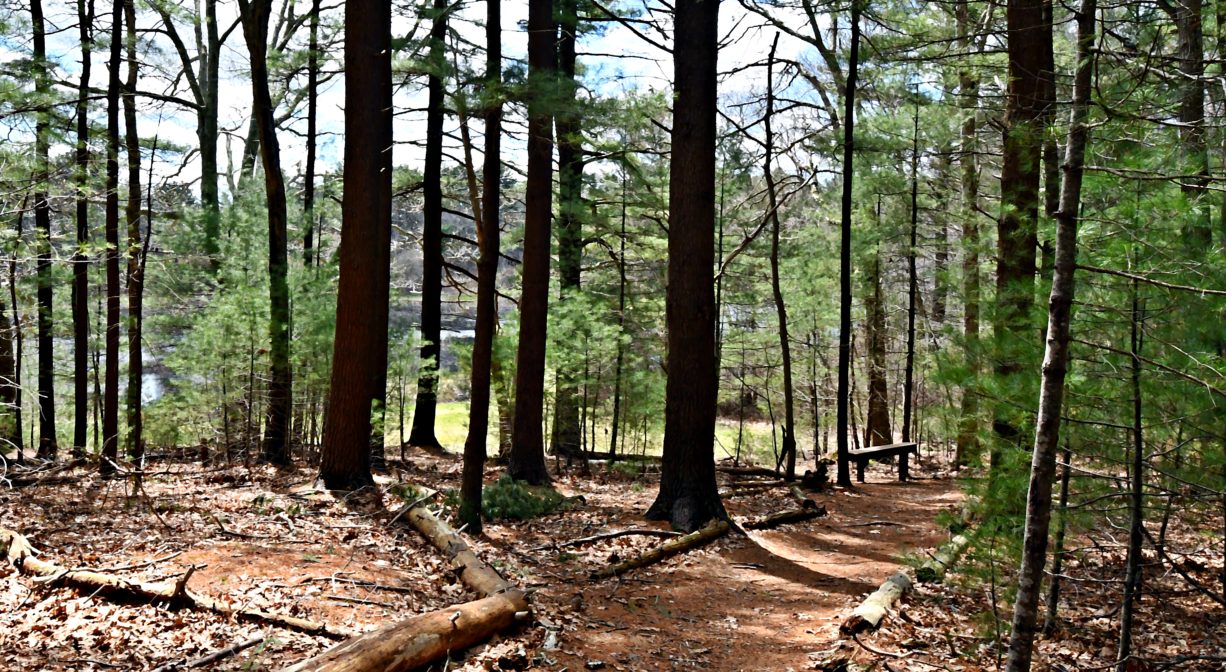
When seeking a quick walk in a beautiful spot, with the chance to see some wildlife, consider the Ellis Nature Preserve. This Marshfield Conservation property totals 27 acres, but the wide, flat trail — for now — is only a half mile. The distance of the trail from the parking area to the clearing by the pond (with picnic tables and a granite block bench) is 0.1 mile.
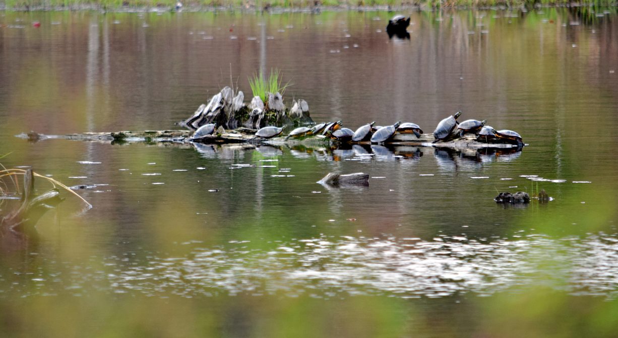
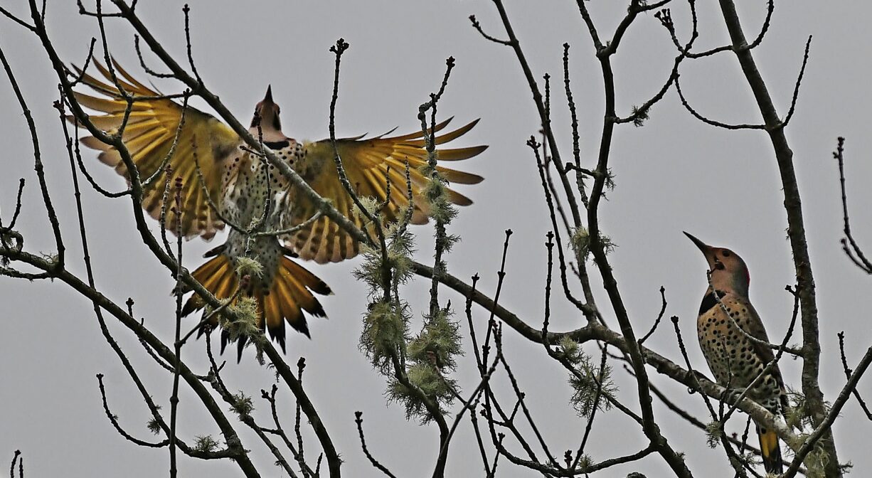
Habitats and Wildlife
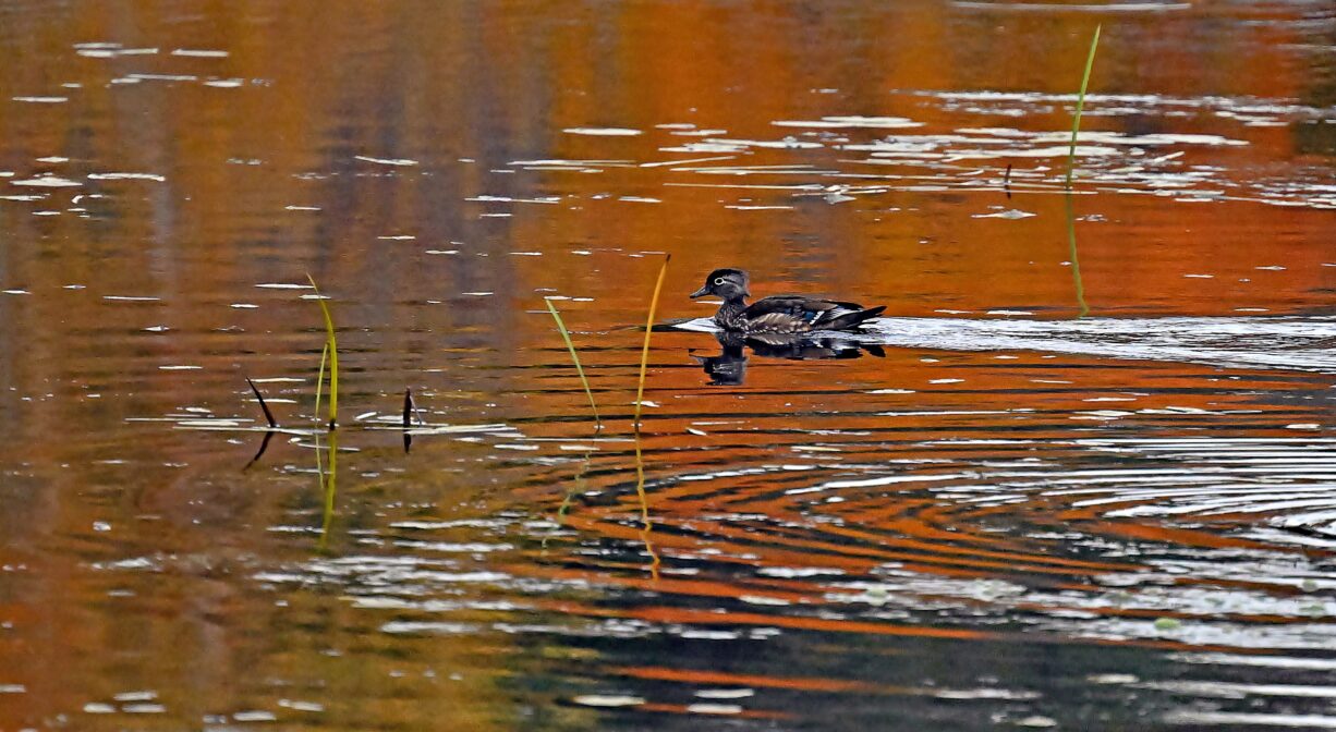
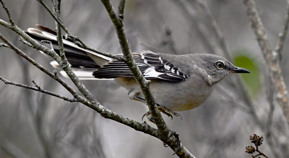
Watch for great blue herons in the wetlands that surround this former cranberry bog. Kingfishers have been spotted here as well. The waters here flow to the South River.
The South River originates deep in Duxbury. Its source is in the Round Pond area, and from there it winds unobtrusively through the woods for several miles. Although one can view it from Route 3, and also from both the South River Bog and the Camp Wing Conservation Area, it remains a narrow and mostly un-navigable stream until just below Veterans Memorial Park. From there it flows through South River Park, behind the playground of South River School, and under the Willow Street and Francis Keville Bridges. Wider at that point, and navigable at most tides, its course winds through the marshes as it runs parallel to Route 139, all the way to Rexhame. From there the river turns northward. It flows for 3 miles between Humarock and the mainland to Fourth Cliff, where it joins the North River at its outlet to the sea.


Historic Site: No
Park: No
Beach: No
Boat Launch: No
Lifeguards: No
Size: 27 acres
Hours: Dawn to Dusk
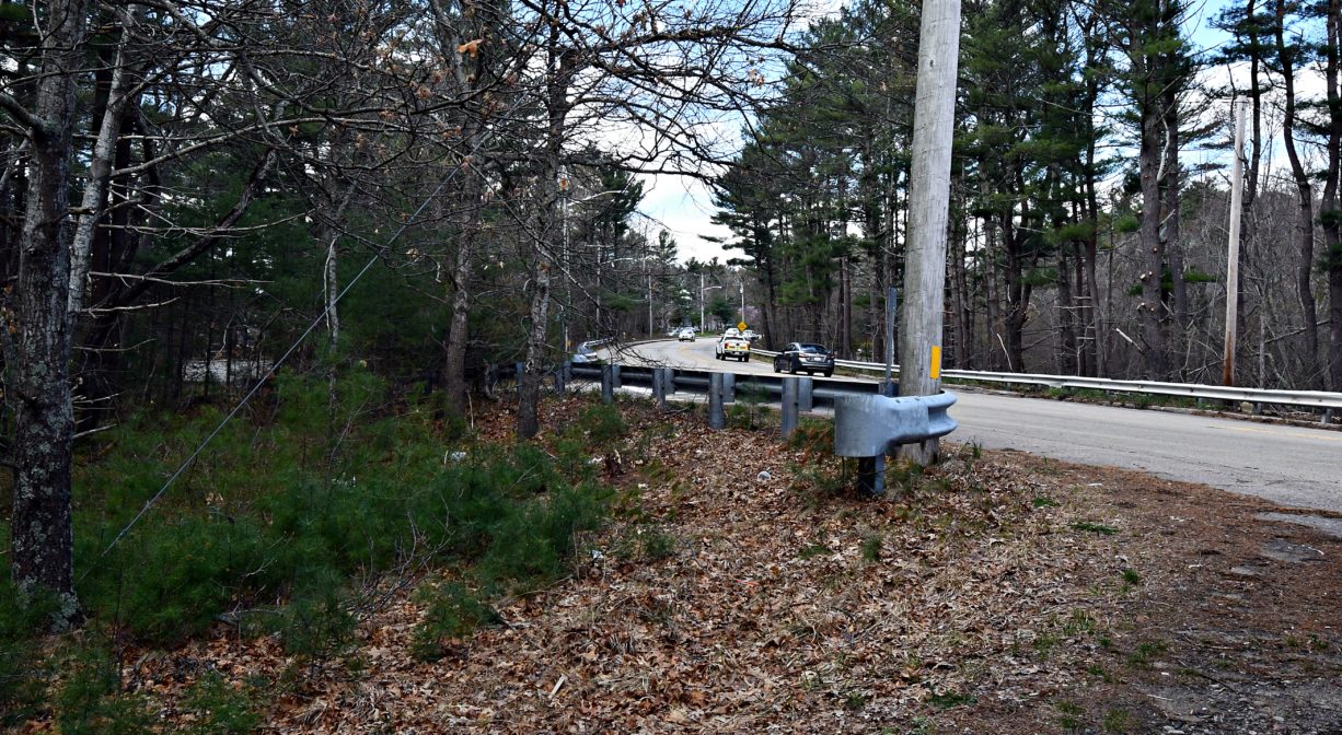
Parking: Limited on-site parking. Look for the small parking lot down a short access road near 214 Plain Street, next to Sandy Hill Drive.
Cost: Free
Trail Difficulty: Easy
Facilities:
Geocache location. Granite block that serves as a bench. Two picnic tables.
Dogs: Dogs must remain on leash. Always clean up after your dog!
Boat Ramp: No
ADA Access: No
Scenic Views: Yes
Waterbody/Watershed: South River watershed