
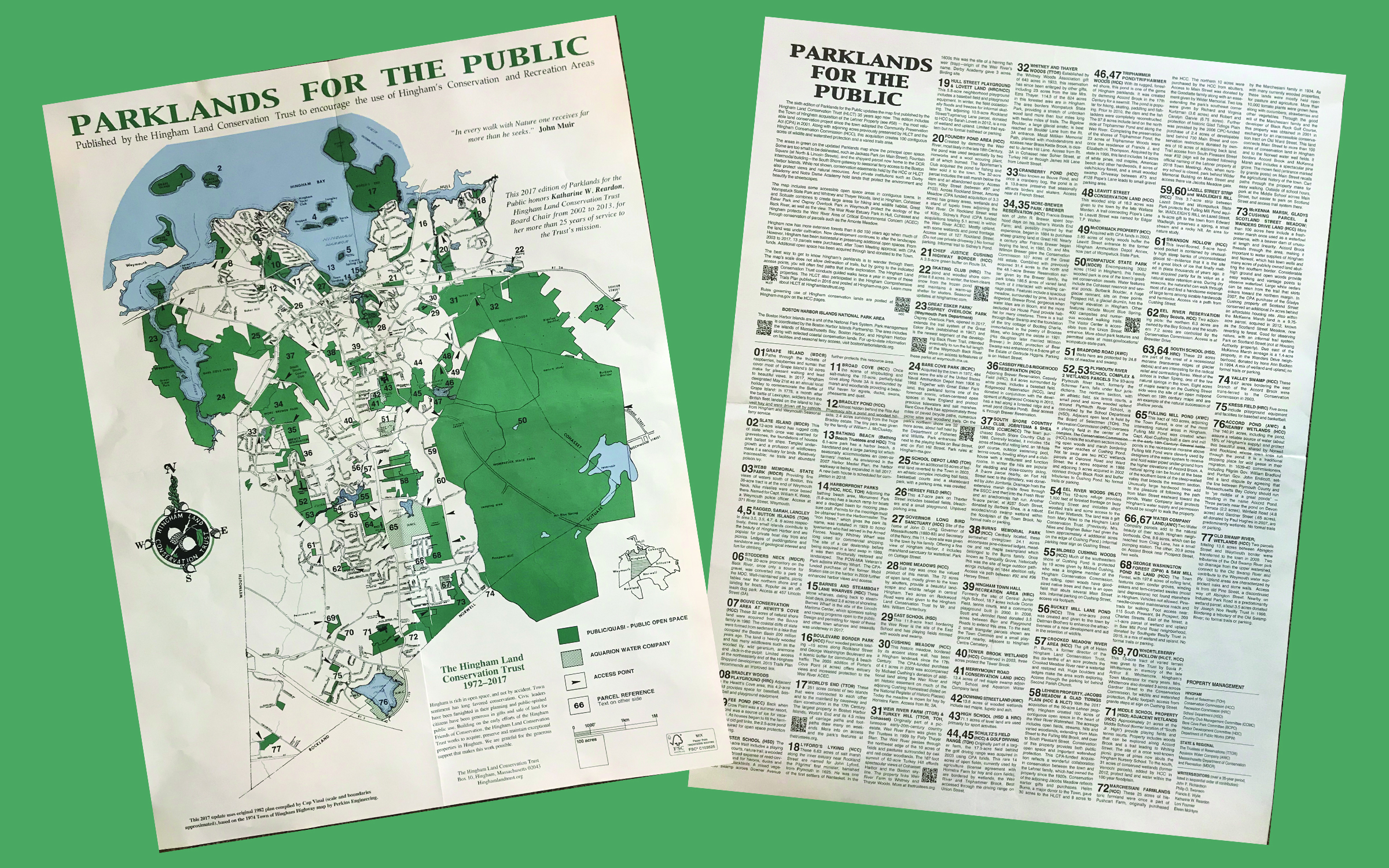
Hingham Parklands for the Public maps are now available at our office. These maps are published by the Hingham Land Conservation Trust to encourage the use of Hingham’s conservation and recreation areas. The map features 78 properties and gives details on the history, wildlife, parking, and more. Hingham is rich in open space, and not by accident. Town leaders have been farsighted in their planning and citizens have been generous in gifts and sale of land for public use. Click here to see an enlarged view of the map.
We also have Norwell Walking Trails Guides available. These maps are from the Norwell Conservation Commission and are funded by the Community Preservation Act Fund. They detail the trails and lands in Norwell that are open for many activities including walking, biking, bird watching, boating and more.
To pick up your copy of either map (available while supplies last), stop by the NSRWA offices during business hours Monday–Friday, 9am-5pm.