
262 Union Bridge Rd, Duxbury, MA 02332, USA
Duxbury Conservation: 781-934-1100 x. 5471
https://www.town.duxbury.ma.us/conservation
Owned By: Town of Duxbury
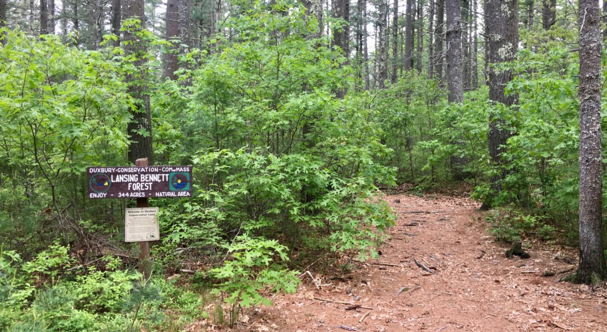
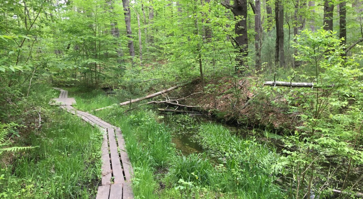
Duxbury’s Lansing Bennett Forest is 344 acres of wooded property along Phillips Brook, owned by the town. It features 2.8 miles of intersecting trails through forest and red maple swamp, with occasional boardwalks. Near the brook, look for remnants of Howlands Mill, a water-powered grist mill and sawmill. The property includes 2 miles of the Bay Circuit Trail. The northwest section links to Matthews Bog and Ashdod Forest.
HUNTING: Archery hunting for deer is allowed on part of this property, in season, by licensed persons in compliance with Massachusetts law. Please be sure to understand state and local hunting guidelines before proceeding. Non-hunters, be mindful of hunting seasons, and wear bright orange if you’re entering the property during those times. Hunting is not permitted on Sundays.
FISHING ADVISORY: It’s important to know that some of our freshwater fisheries are contaminated with mercury, PFAS and/or other concerning substances. The Massachusetts Department of Public Health maintains an online database with up-to-date advisories regarding fish consumption, sorted by location. We recommend you consult this valuable resource when planning a fishing excursion.
Features
Formerly known as Trout Farm Conservation Area, this property is dedicated to Dr. Lansing Bennett, who served as chair of the Duxbury Conservation Commission from 1967-1979. Dr. Bennett helped to develop a greenbelt plan for Duxbury, specifically seeking to preserve land and wetlands along the rivers and streams. During his tenure, the town obtained over 1200 acres of conservation land! Bennett has an interesting biography, especially his post-Conservation Commission years. If you’re curious, look him up online.
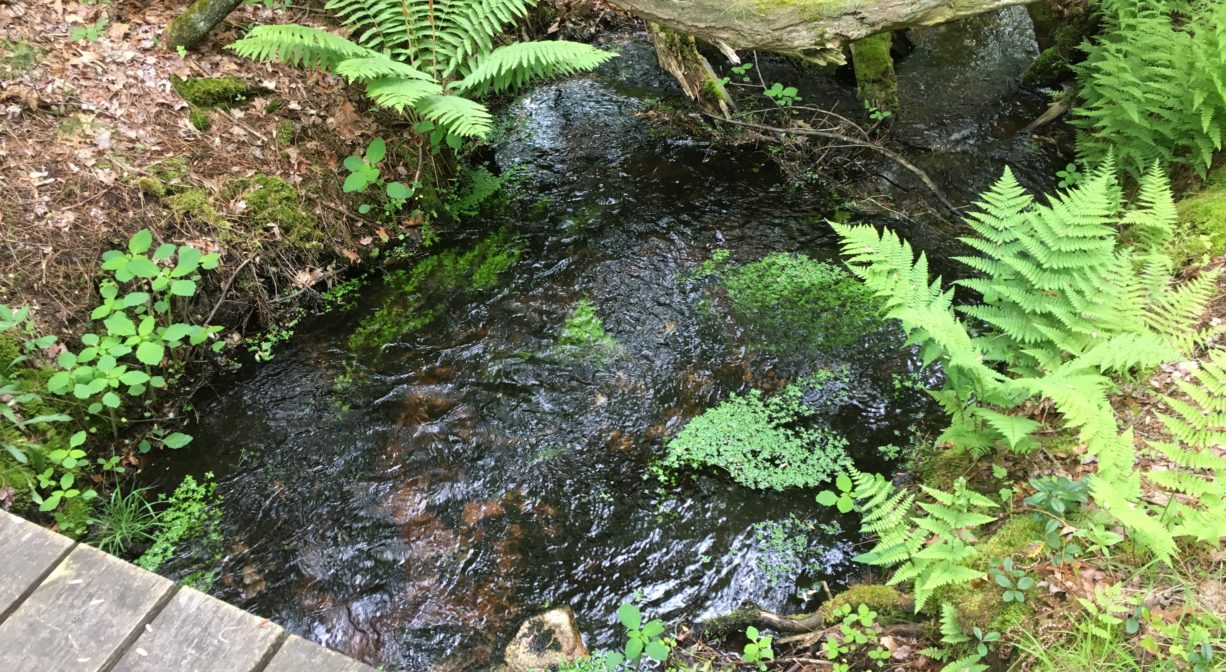
Within the Lansing Bennett Forest, on Phillips Brook, look for the site of one of the last mills built in Duxbury. According to Settlement and Growth of Duxbury 1628-1870 by Dorothy Wentworth, the first mill at this site, circa 1830, was a grist mill. Known as Howlands Mill, it had several owners (it was common for several men to form a partnership to finance a mill). There wasn’t enough water flowing naturally here to power the mill, so a ditch was dug into the side of the hill to the west of Franklin Street, tapping Black Friar Swamp and channelling water to the mill. Many of the cobblestones remain in place today.
This mill site was last operated as a sawmill by the Lot Phillips Company (c. 1850). After the sawmill closed, part of the property became a trout farm (trout were prevalent in Phillips Brook). Fish were raised here, and then sold to markets and restaurants. Both wild brook trout and brown trout still inhabit the brook. The Town of Duxbury purchased Lansing Bennett Forest from the Lot Phillips Company (a wooden box manufacturer) in 1970.
Before this property’s milling era, there was a charcoal pit on site. The local shipbuilding industry in the late 1700s used charcoal in the process of smelting bog iron ore. Remnants of this pit are visible from the trail that leads from the parking area into the property.
Prior to European contact, the Mattakeeset band of the Massachuseuk (or Massachusett) Native American tribe lived for thousands of years in the North River watershed. Their village included most of today’s Pembroke and Hanson. Meanwhile the Patuxet band of the Wampanoag tribe inhabited the Jones River watershed, and the area now known as Kingston, Plymouth and Duxbury. This property lies within the upper portion of the South River watershed — right between those two territories. It’s possible that both tribes utilized the area.
To learn more about local Native American tribes, we encourage you to interact with their members. The Mattakeeset band of the Massachusett, the Massachusett tribe at Ponkapoag, the Mashpee Wampanoag, and the Herring Pond Wampanoag, all share information on their websites.
Trail Description
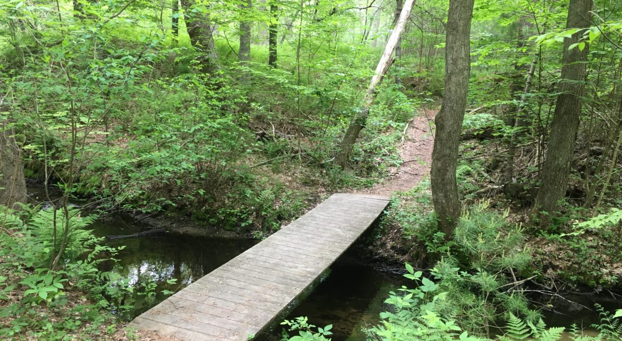
2.8 miles of intersecting trails, marked with red, yellow, white, green, and blue blazes. (The blue loop measures 1.1 miles.) Occasional boardwalks and footbridges. Some sections of the trails are steep. Don’t miss the blue and green trail intersection, which is the location of Howlands Mill Site, a historic and enchanting spot on Phillips Brook!
There are two trailheads that provide quick access to the mill site. The closest is at 937 Franklin Street. Park on the roadside and look for the trail. It’s just a 0.05-mile walk to the mill site. Or park at the roadside at 1013 Franklin Street. From this trailhead, proceed to the trail intersection and turn left. The trail leads to Phillips Brook after 0.1 mile and runs along the brook for another quarter mile, with numerous footbridges. When you see the blue blazes and the bridge on the right, you have arrived at the mill site. After viewing the mill site, which is quite enchanting, you could complete a loop by exiting to the 937 Franklin Street trailhead and walking along the road for 0.25 mile to your starting place.
For a longer walk at this location, check out the larger trail system within Lansing Bennett Forest. There are additional access points on Summer Street, Union Bridge Road and Cross Street, The Lansing Bennett Trail system extends beyond this parcel both to the north and to the south.
There are 2 sections of the property, on either side of Franklin Street. The east side of the property lies on either side of Union Bridge Road. To the west, there are eight access points — four on Union Bridge Road, plus two more on Franklin Street, and one each on Cross Street and Summer Street (Route 53). To the east, a section of the Bay Circuit Trail extends for 1 mile to King Philips Path and Vine Street with occasional boardwalks and footbridges.
The west side of the property features a 1-mile section of the Bay Circuit Trail. It begins just west of Petersons Sawmill Pond, on Union Bridge Road, connects to Matthews Bog, and continues through woods and wetlands to Keene Street where it intersects with Ashdod Forest and another section of the Bay Circuit Trail. Along the way, you’ll find occasional boardwalks and bridges. The presence of an old well and a bottle dump suggest that it wasn’t always woodland. Throughout the property, the Bay Circuit Trail is marked with white blazes.
Habitats and Wildlife
This property is mostly a pine and oak upland forest, with a small portion of hemlock, yellow birch, and holly, and lots of fern, sweet pepper bush, and high bush blueberry. You may also see wild strawberry and raspberry. But be careful, as poison ivy is also present! Wetlands areas are primarily red maple swamp. Much of land here is within the watershed of Phillips Brook, a tributary to the South River. The terrain is far from flat, with lots of kettle holes — pits or depressions formed by melting chunks of glacial ice.
Mice, chipmunks, squirrels, raccoons, and opossums call this forest home. You may also spy a white-tailed deer. In the wetlands, look for turtles, salamanders, toads, and frogs. Birders might spot chickadees, sparrows, blue jays, woodpeckers, red-tailed hawks, or even a great horned owl. Wild brook trout and brown trout are drawn to cold water streams like Phillips Brook. They especially favor secluded spots where they can hide, such as deep pools, whirlpools, and the covered edges of stream banks.
The pond at Lansing Bennett Forest (near the Summer Street entrance) is named Phillips Mill Pond. It is not a natural pond, but instead was created by the construction of a mill dam. Phillips Brook flows through the pond, heading northeast, and then flows through Peterson’s Sawmill Pond a little farther downstream. It continues northeast into the Camp Wing Conservation Area, where it flows into the South River.
The South River originates in Duxbury. Its source is in the Round Pond area, and from there it winds unobtrusively through the woods for several miles. Although one can view it from Route 3, and also from both the South River Bog and the Camp Wing Conservation Area, it remains a narrow and mostly un-navigable stream until just below Veterans Memorial Park in Marshfield. From there it flows through South River Park, behind the playground of South River School, and under the Willow Street and Francis Keville Bridges. Wider at that point, and navigable at most tides, its course winds through the marshes as it runs parallel to Route 139, all the way to Rexhame. From there the river turns northward. It flows for 3 miles between Humarock and the mainland to Fourth Cliff, where it joins the North River at its outlet to the sea.


Historic Site: No
Park: No
Beach: No
Boat Launch: No
Lifeguards: No
Size: 344 acres
Hours: Dawn to Dusk
Parking: Limited roadside parking along Union Bridge Road and at 937 and 1013 Franklin Street.
Cost: Free
Trail Difficulty: Easy, Medium
Facilities:
Boardwalks and bridges in some of the wetlands areas. Geocache location.
Dogs: All dogs shall be effectively restrained and controlled by a chain or leash, or otherwise under the immediate and effective control of a handler, or confined to a motor vehicle. Each person who owns, possesses or controls a dog shall remove and properly dispose of any feces left by his/her dog. For current rules see: https://www.town.duxbury.ma.us/animal-control
Boat Ramp: No
ADA Access: No
Scenic Views: Yes
Waterbody/Watershed: Phillips Brook (South River watershed)