
NATURE
by Kezia Bacon, Correspondent
This month we’re shining a spotlight on the Jones River watershed — a next-door neighbor to the North and South Rivers, and the Jones River Watershed Association, our partner and ally in protecting, restoring, and enhancing our local natural resources. The Jones River finds its source at Silver Lake, as well as various wetlands and small streams. It flows for 7.5 miles to its outlet at the sea at Kingston Bay.
The town of Kingston has quite a few conservation properties, nearly all of them are on the Jones River or one of its tributaries. Like the North and South Rivers, the Jones is a stream that was a primary thoroughfare for the aboriginal tribes that inhabited our region prior to colonization. European settlers relied on the Jones as well, for transportation, for sustenance, and for salt marsh hay, a naturally-occuring, multi-use crop. They named the river for Christopher Jones, the captain of the Mayflower. In later years, the river was a center of industry, with 18 different saw, grist, and fabric mills, and still later, an iron works and several tack factories.
Before Kingston was incorporated as a town in 1726, it was actually known as “Jones River” — a village of Plymouth! The river itself owes much of its present-day health and accessibility to the Jones River Watershed Association (JRWA), which was founded in 1985. Thanks to JRWA’s dam removal projects on Wapping Road and Elm Street, the river now flows freely below the Silver Lake dam. And thanks to JRWA’s annual herring counts, as well as their successful advocacy for a temporary fish ladder at the Forge Pond Dam, this historic herring run is now on the rebound!
Would you like to explore new territory this fall and winter? Be sure to visit the properties listed below. Proceed with caution, as it’s going to take a while for some of these properties to recover from the October Nor’easter. Also, consider participating in our Explore South Shore Contest, for which you’re invited to post photos from your adventures to Instagram with the hashtag #ExploreSouthShore. Each month we randomly select a winner from the posts to receive a prize package. We’ll also be featuring walks in Kingston every day in November on Instagram.
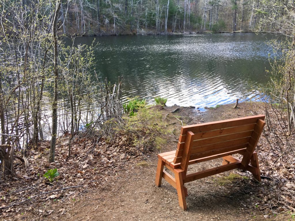 Stewart/Person Preserve
Well-tended woodland trails encircle two mill ponds at this enchanting, 27-acre Wildlands Trust property, where an abundance of wildlife thrives. Enjoy up-close views of a woodland stream and a historic fish ladder, which provides access to migratory fish to their spawning ground upstream at Russell Pond. Limited roadside parking on Sylvia Place Road. https://www.nsrwa.org/listing/stewart-person-preserve/
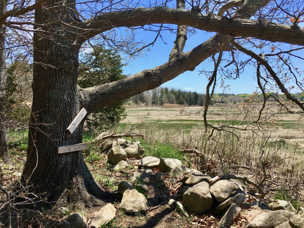
Samson Forest & Memorial Park
Begin your visit at the observation platform at this town-owned property, or take a walk across the Elm Street Bridge to look farther upstream on the Jones River. From the 1920’s to 2019, a concrete dam stood at this site. Thanks in large part to the dedicated work of the Jones River Watershed Association, what you see now is a riverbed in the process of regenerating. Continue your visit on the trails, which crisscross 200 acres of forest, and feature old stone walls and glacial erratic boulders. Small parking area on Elm Street. https://www.nsrwa.org/listing/sampson-forest-memorial-park/
 The Nook Preserve
It’s a short walk to a gorgeous view at this 17.5-acre Wildlands Trust property. Located close to the mouth of the tidal Jones River, in earlier times this spot was favored by Native Americans for summer encampments. Old stone walls indicate its more recent use as farmland. History lovers, be sure to cross the street to visit the homestead site of John Howland, a Pilgrim. Roadside parking on Howlands Lane, across from Leigh Road. https://www.nsrwa.org/listing/the-nook-preserve/
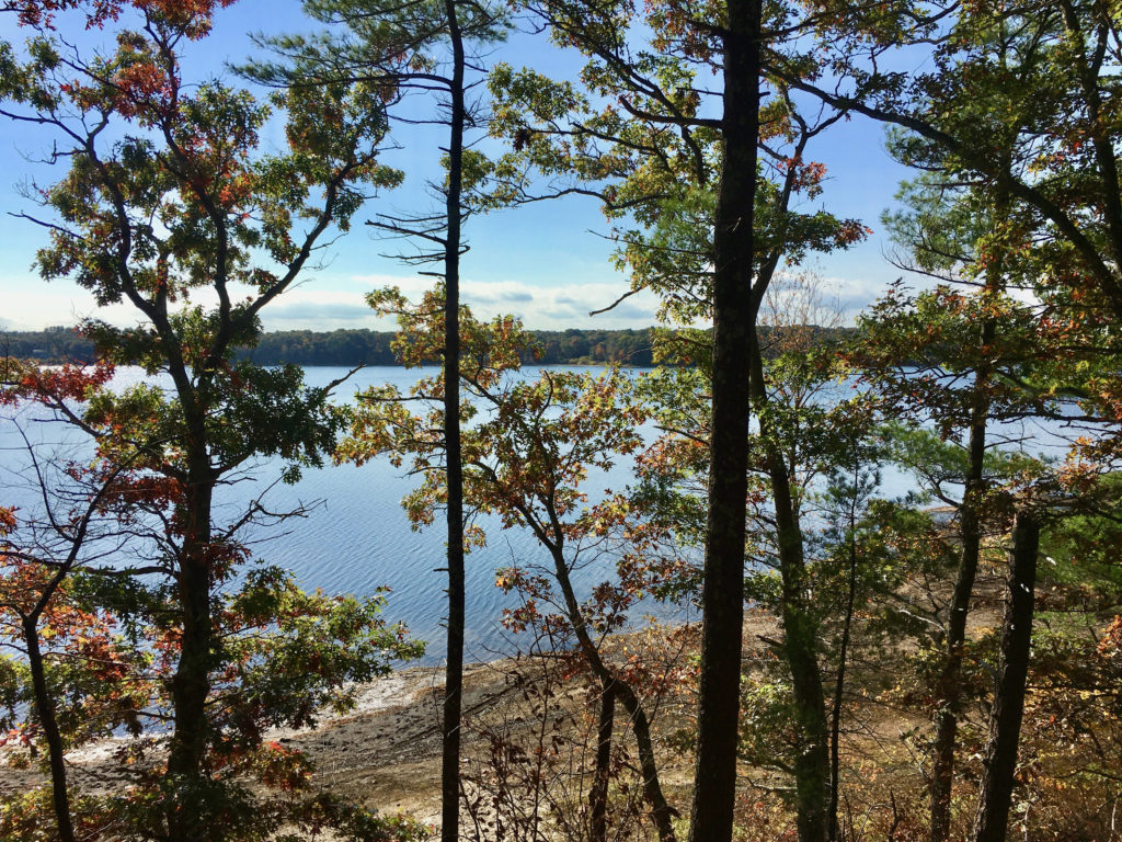
Silver Lake Sanctuary
This 99-acre town-owned lakeside property offers 1.3 miles of trails. From the parking lot, follow the trail to the left. It ascends a ridge to an overlook where you can enjoy a wide view of Silver Lake, the source of the Jones River. Continue in the same direction to find the path to the lake shore. Surprising fact: water from Furnace Pond in Pembroke, a headwater to the North River, is regularly diverted into Silver Lake to enhance the City of Brockton’s water supply. Limited parking at the end of Barses Lane. https://www.nsrwa.org/listing/silver-lake-sanctuary/
Patuxet Park
The Patuxet, a subset of the Wampanoag tribe, used this property as a summer encampment prior to European settlement. The 23-acre town-owned property provides a short walk along wetlands, and through woods and open fields. Enjoy close-up views of Smelt Brook, a tributary to the Jones River. Limited roadside parking at the end of Basler’s Lane. https://www.nsrwa.org/listing/patuxet-park/

Cranberry Watershed Preserve
This 240-acre town-owned parcel, immediately adjacent to Silver Lake High School, offers 5+ miles of walking trails through woodlands and wetlands, and around retired cranberry bogs. The Jones River, Pine Brook, and Howard’s Brook all flow through the property, which may be too large to explore in a single visit! Limited parking on Lake Street (3-4 cars). https://www.nsrwa.org/listing/cranberry-watershed-preserve/
Gray’s Beach Park
For a short, paved walk and some beautiful shoreline views, consider this multi-use 6.5-acre town-owned public park, which offers free parking from November to March. Located on Kingston Bay. https://www.nsrwa.org/listing/grays-beach-park/
Camp Nekon
In a former life, this 193-acre forested, town-owned parcel was a Girl Scout camp. Now it is owned by the Town of Kingston. The property contains 2+miles of trails and unpaved roadways, a DCR fire tower, and a small beach on Smelt Pond. There are quite a few additional small ponds located within, making it a prime spot for viewing wildlife. The streams, ponds and swamps on this property flow to Smelt Brook, a tributary to the Jones River. Limited on-site parking on Monks Hill Road. Look for the light blue sign. https://www.nsrwa.org/listing/camp-nekon/
Bay Farm
Part Kingston, part Duxbury, this 80-acre town-owned property offers 2+miles of varied trails through woodlands and meadows, with spectacular views of Kingston Bay. The 42nd parallel runs through the Kingston side of Bay Farm. Look for the marker on Landing Road. Bay Farm is also the southern terminus of the Bay Circuit Trail. Look for the informational kiosk near the shoreline on the Kingston side. Limited on-site parking on Landing Road in Duxbury. https://www.nsrwa.org/listing/bay-farm/
 Hathaway Preserve
Located on Spring Brook and the Jones River, these 77 town-owned acres offer established trails, four bridges, and a boardwalk. The property is contiguous with Three Rivers Basin Area and Cranberry Watershed Preserve, creating an extensive swath of open space within a sensitive ecological area. Look for the entrance on the northern side of Wapping Road (Route 106) along a line of cedar trees just north and west of the cranberry bogs. Follow the dirt road over the hill and then look for the parking area. (Access road may not be suitable for all vehicles.) https://www.nsrwa.org/listing/hathaway-preserve/
Kezia Bacon’s articles appear courtesy of the North and South Rivers Watershed Association, a local non-profit organization devoted to protecting our waters. For membership information and a copy of their latest newsletter, contact NSRWA at (781) 659-8168 or visit www.nsrwa.org. You will also find 25+ years of Kezia’s Nature columns there. For more information about the Explore South Shore 2021 Contest, visit https://www.nsrwa.org/get-outdoors/explore-south-shore-2021-contest/