
NATURE
by Kezia Bacon, Correspondent
This month NSRWA features the town of Abington in its 50 Places to Explore Contest. Abington lies in the watershed of three river systems. French’s Stream, in the northeast quadrant, flows to the North River. Beaver Brook, in the westernmost part of town, flows to the Matfield River. But most of Abington centers on the Shumatuscacant River, which flows to the Satucket River. Parks and other public lands provide walking trails and diverse views of the river, whose name has been interpreted to mean both “spring meadow” and “beaver river.” I was pleased to make its acquaintance!
Abington is home to a number of conservation properties, however many of them are maintained as wildlife habitat, without public trails. While exploring the town, I was pleased to stumble upon the relatively new Griffin Dairy Farm, with its pleasant loop trail suitable for all abilities. Island Grove Park and the Ames Nowell State Park may be better known, but be sure to check out the trail at Beaver Brook Playground. It might be the best-kept secret in town!
 Thompson Pond Trail
This trail system is located on the former South Weymouth Naval Air Station. It extends for nearly two miles through meadow and forest, offering views of French’s Stream and — of course — Thompson Pond. Heading north from the trailhead on Spruce Street, you’ll enter a vast open field. It’s easy to imagine the runways that existed here in decades past. Options are to follow a gravel road or choose a narrower route through the grass. After a sharp left turn, the trail crosses the West Branch of French’s Stream, and continues past the manmade Thompson Pond, which was created to help restore the natural wetlands that once existed on this site. Most of the trail is flat, but there are sections near the pond with a relatively steep slope. Designated parking area on Spruce Street. Visit: https://www.nsrwa.org/listing/thompson-pond-trail/
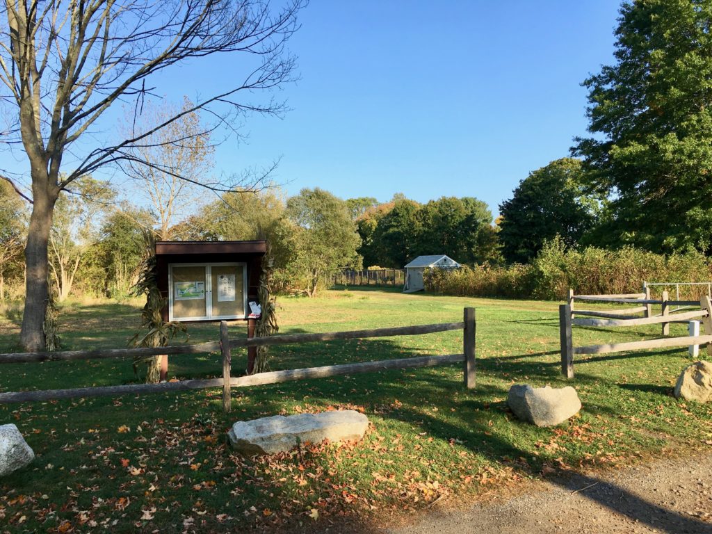
Griffin Dairy Farm
Renovated in 2017, this 64-acre town-owned property offers a glimpse of Abington’s agricultural past with a modern twist. From 1925-1965, Lawrence & Annie Griffin operated a dairy farm here, producing bottled milk, corn, and hay. In later years, it was leased by the HP Hood Company. Now it’s the location of the Abington Community Garden, as well as a weekly summer farmers market. The parcel also features an athletic field and a picnic area. At the center is a flat, half-mile gravel loop trail, surrounded on all sides by meadow, with the occasional wetland. Spur trails lead to parking areas on Plymouth Street and Pattison Street. Extend your walk by turning right on Pattison, then left on Charles, to access the Rockland Rail Trail. An intermittent stream bisects the property, with footbridges providing trail crossings. The waterways here drain to the Shumatuscacant River. Visit: https://www.nsrwa.org/listing/griffin-dairy-farm/
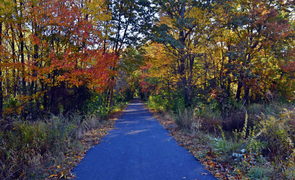 Rockland Rail Trail
Although it is named for Rockland, this 3-mile paved trail extends into Hanover and Abington. There are numerous access points — including the Rockland Police Station, the Rockland Senior Center, and Rockland High School. You can also pick up the trail at its outermost point, on Circuit Street in Hanover, or at its closest proximity to MBTA’s Commuter Rail, on Monroe Street in Abington. Because it is fully paved, it can be used not only by hikers and cyclists, but also by people who use walkers, wheelchairs, and baby strollers. The Hanover Branch Railroad once extended from Hanover Four Corners, through South and West Hanover, across Rockland, to North Abington, where it connected with the Old Colony Railroad to Plymouth. It officially opened for service in 1868, and continued to operate into the 20th century. Today’s Rail Trail crosses over French’s Stream, which is one of the sources of the North River. It flows through Weymouth and Rockland into Hanover, where it joins the Drinkwater River, eventually becoming the Indian Head River. Visit: https://www.nsrwa.org/listing/rockland-rail-trail-hanover-branch-rail-trail/
 Island Grove Park
The “Crown Jewel” of Abington’s public parks, this historic 53-acre property is set on a large pond, which is actually a dammed section of the Shumatuscacant River. The adjacent forest features about a mile of walking trails, plus swimming, fishing, ice skating, and a playground. A dramatic Memorial Arch and Bridge, constructed in 1912, stands in memory of the town’s Civil War soldiers and sailors. Additional memorials within the park commemorate the annual (1846-1865) “August First” meeting of William Lloyd Garrison and his fellow abolitionists. This is a beautiful place to walk, in any season. The trees and the water provide a fascinating and ever-changing backdrop. There is ample on-site parking at 123 Park Street. Visit: https://www.nsrwa.org/listing/island-grove-park/

Butterfly Park
Blink and you might miss this tiny 0.2-acre parcel, just upstream of Island Grove Park. Located directly on the Shumatuscacant River, this enchanting little spot invites visitors to observe the natural world. The plantings, maintained by the Abington Garden Club, are designed to attract butterflies. There aren’t any trails, but this very small park is a lovely setting for a quick breath of fresh air, or to contemplate nature. Limited parking at 199 Central Street. Visit: https://www.nsrwa.org/listing/butterfly-park/

Beaver Brook Playground and Mt. Vernon Cemetery
At first glance, this 12.5-acre property at the end of Ralph Hamlin Jr. Blvd. might appear as simply a playground within a public school complex. But look closely and you’ll find something wonderful. To the right of the playground, there is a small fishing pond. Cross the bridge beside the pond and you’ll find several trails. Take the one to the right. It continues through the woods, along the banks of the Shumatuscacant River. The trail may be relatively short (0.3 mile), but it proceeds over rolling hills, alongside a secluded section of river… plus you can extend your walk through the historic Mount Vernon Cemetery. It’s actually quite lovely! A quick note about the name: the land that is now Abington was once known as Manamooskeagin (“land of many beavers”). Even though the facilities on this property are named for Beaver Brook, it’s actually the Shumatuscacant River that flows through. Beaver Brook itself is located elsewhere in town! The Shumatuscacant is part of the Satucket River watershed; Beaver Brook is part of the Matfield River watershed. They both eventually flow into the Taunton River. Visit: https://www.nsrwa.org/listing/beaver-brook-playground/
 Ames Nowell State Park
Abington’s largest open space parcel, this 700-acre state park spreads out around Cleveland Pond. There are ten miles of trails — some wide, some narrow — with options for short walks and longer adventures. Many are marked with numbered blue blazes, but quite a few are not. Bring a map! While mills existed on this site as early as the 1700s, the pond was created in 1920, when Edwin Holmes dammed Beaver Brook. He maintained the land as a bird sanctuary and hunting spot, but lost it during the Depression. The park’s namesake, Ames Nowell, the grandson of Massachusetts Governor Oliver Ames, purchased it next. Beaver Brook enters the property from the north and flows through the pond, continuing south through Abington and Bridgewater, eventually merging with Spring Brook and emptying into the Matfield River. Ample on-site parking on Linwood Street. Visit: https://www.nsrwa.org/listing/ames-nowell-state-park/
Kezia Bacon’s articles appear courtesy of the North and South Rivers Watershed Association, a local non-profit organization devoted to protecting our waters. For membership information and a copy of their latest newsletter, contact NSRWA at (781) 659-8168 or visit www.nsrwa.org. You will also find 20+ years of Kezia’s Nature columns there. For more information about the 50 Places to Explore Contest,” visit https://www.nsrwa.org/get-outdoors/enter-the-nsrwa-50-places-to-explore-contest/