
NATURE
by Kezia Bacon, Correspondent
This month NSRWA features the town of Hanson in its 50 Places to Explore Contest. When I began researching this article, I had visited only half of the properties on this list. Two of them I hadn’t even heard of! For the past few decades, Hanson has been quietly acquiring and improving open space parcels. As the years pass, it will it continue to increase both the visibility and the accessibility of these spots.
Rocky Run was the first conservation area I ever visited in Hanson, many years ago, and it quickly became one of my favorites throughout all of the South Shore. Fern Hill Cemetery was a pleasant recent discovery. It offers not only a view of, but access to, Wampatuck Pond! I might have entirely missed the best part of Smith-Nawazelski Conservation Area, if not for a journey down an internet rabbit hole that unearthed photos of the property’s boardwalk over Poor Meadow Brook.
Some of Hanson’s open spaces are either still in the planning stages, or intended to be kept wild. The Carolyn Ready Conservation Area on Holmes Street is well-marked but does not appear to have trails. The Hunt Preserve on Winter Street has been reserved solely for wildlife habitat. Various parcels in the Poor Meadow Brook watershed are awaiting funding and/or a higher position on the priority list. It’s exciting to see the pieces fall into place. In the meantime, the list below provides 9 places you can visit today, most of them are large enough for an hourlong walk.
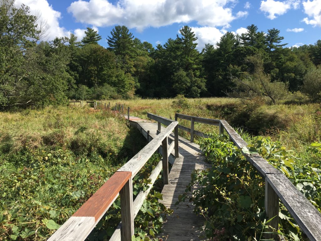
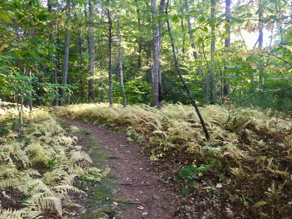
Smith-Nawazelski Conservation Area
From its entrance on Elm Street, this 111-acre property may appear lackluster. But follow the trail along the power easement all the way to the rear of the parcel, and you’re in for a pleasant surprise. First head into the woods; a short distance farther, turn right toward the freshwater marsh. Within a few steps, you’ll be on an extended (if rustic) boardwalk that traverses Poor Meadow Brook and its wetlands. It is a beautiful spot! Additional trails snake through the woods and alongside farmland. There are at least 2 miles to walk here — mostly wide cart paths but also sometimes narrow footpaths. Limited on-site parking at 482 Elm Street. https://www.nsrwa.org/listing/smith-nawazelski-conservation-area/
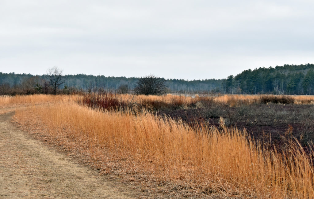 Burrage Pond Wildlife Management Area
You could spend all day touring the trails of this 2,000+ acre property, which is managed by the state as fisheries and wildlife habitat. Want to hike with a friend and have an extended conversation? This is your spot. There are 10 miles of walking trails, around ponds, marsh, swamps and retired cranberry bogs. Birders love this place, in part because of the wood ducks that breed here. Local history buffs might enjoy knowing that it was once logged for cedar, and later for peat, before becoming a large cranberry enterprise. Like Smith-Nawazelski, it is part of the Satucket River watershed, with Stump Brook providing an outlet. Ample parking at 382 Pleasant Street. Additional limited parking at 483 Elm Street. https://www.nsrwa.org/listing/burrage-pond-wildlife-management-area/
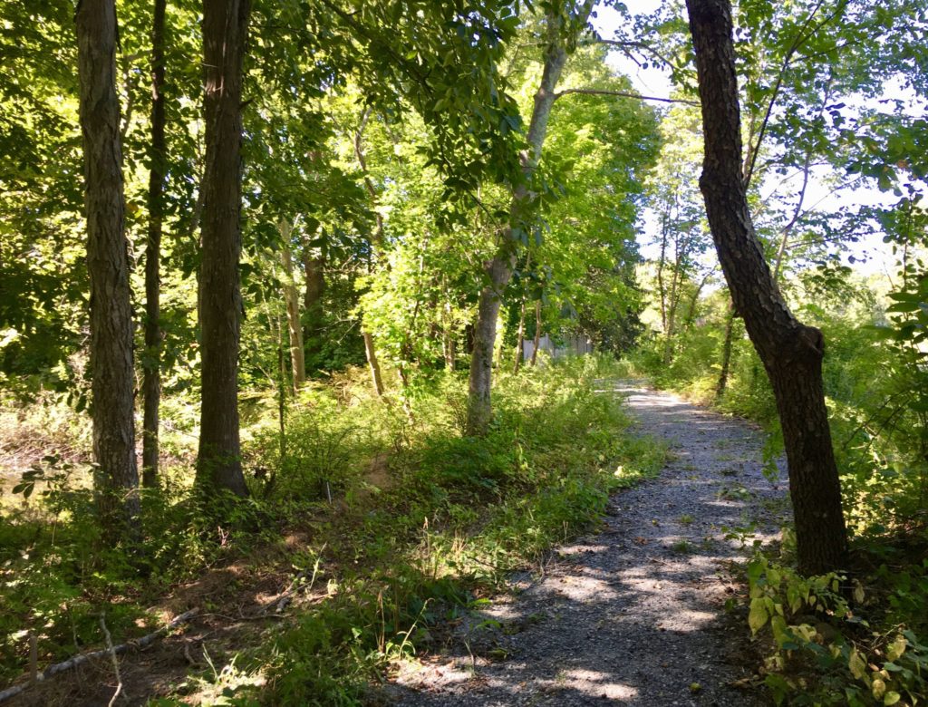
Poor Meadow Brook Conservation Area
At present, walking access to this 115-acre property is limited to a very short gravel pathway along West Washington Street, and some narrow footpaths into the woods. But that’s likely to change in the future. But if you wish to explore by canoe or kayak, there’s a lot more to see. The gravel path leads directly to the Shumatuscacant River, where you can launch a small boat and set off downstream. Downstream is the confluence of the river and Poor Meadow Brook, and also (as reported) evidence of beaver activity. This too is part of the Satucket River watershed. Limited on-site parking at 891 West Washington Street (Route 14). https://www.nsrwa.org/listing/poor-meadow-brook-conservation-area/

Fern Hill Cemetery & Wampatuck Pond
Another spot that offers opportunities for both walking and paddling is the historic Fern Hill Cemetery. Situated on a hill directly adjacent to Wampatuck Pond, this beautiful 6.6-acre property dates back to 1748. The public is welcome to stroll the rolling gravel roads that extend along the perimeter and among the rows of headstones — some old, some new. A staircase at the back leads down to the shore, where there is water access for canoes, kayaks and fishing. Wampatuck Pond was created in 1695 by the damming of Wampatuck Brook. It lies within the Indian Head River watershed. Follow the paved road from the entrance on High Street to the rear of the cemetery, where you’ll find small parking area overlooking the pond. https://www.nsrwa.org/listing/fern-hill-cemetery/

The Last Meadows
For a rare glimpse of Hanson’s agricultural past, check out this still-evolving 56-acre property. For centuries it was farmland. When the Plymouth County Hospital purchased it in 1920, much of the rural character was preserved. Some outbuildings remain, but the large facility that once stood here was demolished in 2017. Now owned by the town, the land is maintained for open space and wildlife habitat. Thanks to a 2020 MassTrails grant, a new trail leads through woods to a large open meadow. Wampatuck Pond is nearby, and there are plans to extend the trail to its shores. There is also a shorter forest trail, along a ridge, closer to the entrance. The lands here lie within the Indian Head River watershed. Ample parking at 228 High Street. Facing away from the street, the trail begins on the paved road to the right of the water tower. https://www.nsrwa.org/listing/the-last-meadows/
 Veterans Memorial Town Forest
Working our way around Wampatuck Pond, we now arrive at the 37-acre Town Forest, a quiet expanse of woods and wetlands with some lovely water views. Overcrowded trees are selectively harvested here, to preserve the long-term health of the forest. There is a network of about 1 mile of well-trodden intersecting paths. Parking and trail access at the athletic fields on Route 58, and at the cul de sac at the end of Indian Trail. Look for the informational kiosk across the street from the Indian Head School. https://www.nsrwa.org/listing/veterans-memorial-town-forest-hanson/
 Alton J. Smith Reserve
A short way down Route 58 is another pond, the Indian Head. Right next door is the Alton J. Smith Reserve, a 103-acre retired cranberry bog surrounded by walking trails and wetlands. The Natural Resource Conservation Service is currently funding a restoration program here, to convert the streams and bog back to their natural state. A network of wide, flat roads provide ample space for walking and numerous opportunities for spotting wildlife. Parking and access from the Marcus L. Urann Fisherman’s Landing, off Route 58, and also behind the stone gatehouse on Camp Kiwanee Road. Additional spur trails through the woods lead to Camp Kiwanee and the J. J. Shepherd Town Forest in Pembroke. The headwaters of Indian Head Brook are located on this property. Indian Head Brook flows north from Indian Head Pond, through Wampatuck Pond and Little Cedar Swamp, into the Indian Head/Drinkwater River, which then flows into the North River and out to sea. https://www.nsrwa.org/listing/alton-j-smith-reserve/
 Rocky Run Conservation Area
Small but beautiful, this 13-acre property is one of the most intriguing spots on the South Shore — a low valley of shady forest on the banks of the Indian Head River and Rocky Run Brook. Narrow footpaths extend up and down ridges to the water’s edge. Wider cart paths explore the property’s interior. The remains of a large stone/earthen dam reveal the area’s industrial past. Together with the Tucker Preserve, the Indian Head River Trails, and Luddam’s Ford in both Pembroke and Hanover, Rocky Run is part of a network of trails that leads up one side and down the other side of the river. The 4-mile hike is steep at times, and perhaps not the easiest to follow, but it is a fascinating place to explore. Limited parking on State Street, next to the bridge. https://www.nsrwa.org/listing/rocky-run-conservation-area/
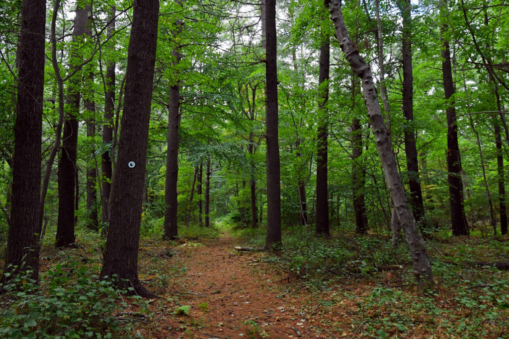
Webster-Billings Conservation Area
This 62-acre forest was acquired by the town in 1973. A well-established network of woodland paths creates a peaceful haven. Surrounded by residential areas off East Washington, State and Brook Streets, this is a lovely spot to explore. Look for old stone walls, especially at the boundaries. The primary trail is marked with red paint and (sometimes) pink surveyor’s tape. Numerous spur trails lead off into neighborhoods, and to Indian Head Brook, a tributary to the Indian Head River. Limited roadside parking at the ends of Puritan Avenue, Old Pine Drive and Williams Way. https://www.nsrwa.org/listing/webster-billings-conservation-area/
Kezia Bacon’s articles appear courtesy of the North and South Rivers Watershed Association, a local non-profit organization devoted to protecting our waters. For membership information and a copy of their latest newsletter, contact NSRWA at (781) 659-8168 or visit www.nsrwa.org. You will also find 20+ years of Kezia’s Nature columns there. For more information about the 50 Places to Explore Contest,” visit https://www.nsrwa.org/get-outdoors/enter-the-nsrwa-50-places-to-explore-contest/