
NATURE
by Kezia Bacon, Correspondent
The North and South Rivers Watershed Association was founded 50 years ago, so 2020 is a big anniversary year! The association has grown from 200 citizens to more than 1,600 households. It is now the largest environmental organization on Boston’s South Shore, and serves as a strong advocate for our rivers and local waterways.
The watershed of the North and South Rivers includes 12 towns. One of the many ways NSRWA is celebrating its 50th Anniversary is by highlighting one of these towns each month in 2020, suggesting walks and hosting other events there. There is also a 50 Places to Explore Contest which encourages the public to visit conservation lands and other open space areas within each town.
Since Scituate is the featured town for the month of January, I’ve compiled a list of walking places there, which I encourage you to check out. Many of them were new to me (until this month!) and I’ve been delighted to make some very welcome discoveries. There are just so many beautiful places to explore on the South Shore! I hope you’ll join me in visiting them this year.
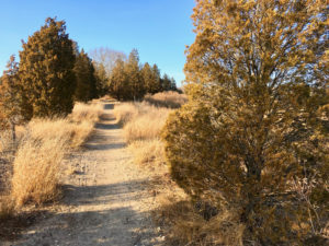
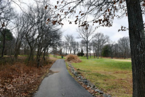 Widow’s Walk: Visit this place first because it’s only open to walkers from late December to March 1. The municipally-owned Widow’s Walk Golf Course debuted in 1997 as the first environmental demonstration course in the US. It is also a Certified Audubon Cooperative Sanctuary, with lots of habitat for birds and other creatures. Don’t miss the view from the Signature Hole, which stands at the top of the tallest hill (a paved path gets you there). On a clear day, you can see the ocean, the Herring River, and the mouth of the North River. It’s spectacular. Park on site at 250 Driftway. https://www.nsrwa.org/listing/widows-walk/
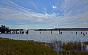
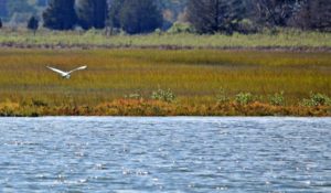 Driftway Conservation Park: Directly across the street from Widow’s Walk is the 334-acre Driftway Conservation Park. From the on-site parking area, it may not seem to offer much in the way of trails, but if you continue along the edge of the water, past the old Boston Sand & Gravel wharves, you’ll find a trailhead and 2+ miles of intersecting, color-coded paths, as well as a very inviting observation deck that extends into the Herring River salt marsh. The trails are varied — through woods, wetlands, sandy areas, and marsh — plenty to explore! https://www.nsrwa.org/listing/driftway-conservation-park/
The next three properties are relatively small. They might be visited alone, or as a group, along with Driftway Conservation Park, above.
 Driftway Multi-Purpose Path: If you park at Driftway Conservation and walk away from the water, toward the street, you will find yourself on the Driftway Multi-Purpose Path, which is 1.5 miles of paved trail for walking and cycling (it looks like a sidewalk). Follow the path in either direction for views of the Herring River and its marshes, as well as the outer reaches of Widow’s Walk Golf Course and the Driftway Conservation Park. Additional parking at Herring River Trail, at 32 New Driftway, next to Dunkin. https://www.nsrwa.org/listing/herring-brook-trail-and-driftway-multi-purpose-path/
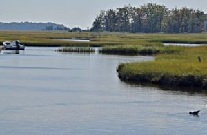 James Landing Walkway: Another small but worthwhile property is the James Landing Walkway, a 0.3-mile trail that extends along the edge of the salt marsh, with gorgeous views of the Herring River. Park at Driftway Conservation, and walk toward the street, turning left on the sidewalk/Multi-Purpose Path. A short distance (0.3 miles) down the path, look for a dirt trail that veers off to the left. This is the beginning of the James Landing Walkway. Be please mindful of private property while walking here. https://www.nsrwa.org/listing/james-landing-walkway-and-herring-river-marina/
 Herring River Trail: At the western terminus of the Driftway Multi-Purpose Path (32 New Driftway, next to Dunkin), there is a very small parking area. This is also where you’ll find the Herring River Trail. What once was a railroad bed is now a wide, flat, 0.4-mile path through woods and marshland. This is a great spot to stretch your legs and enjoy a quick dose of Mother Nature. The views are quite nice! https://www.nsrwa.org/listing/herring-river-trail/
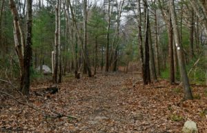
 Bates Lane Conservation Area: Scituate’s West End offers abundant open space, with carefully tended, well-marked trails. Park at the Mount Hope Improvement Society, 287 Clapp Road, and look for the trailhead across the street. Within this 335-acre woodland, you’ll find enchanting streams, groves of American Holly trees, glacial erratic boulders, and plenty of old stone walls. Plan for multiple visits, as there is so much to explore here! https://www.nsrwa.org/listing/bates-lane-conservation-area/
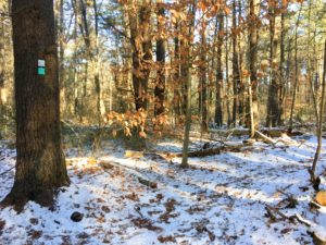 Higgins-MacAllister Preserve: Immediately adjacent to the Bates Lane property, the Higgins-MacAllister Preserve offers another 37 acres of woodlands, boulders and streams. The best way to access this spot at the moment is off the Carl Pipes Trail, in the Bates Lane Conservation Area. Follow the teal trail markers, and don’t miss the Boulder Loop or the enormous Eastern White Pine tree. https://www.nsrwa.org/listing/higgins-macallister-preserve/
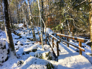
 Hubbell Preserve: This place is special. Beautiful and varied, it is worth visiting in any season, except perhaps when there’s ice on the ground. Located in a quiet corner of North Scituate, this 40-acre property features a 0.7-mile trail through the woods, past (and sometimes over) moss-covered rocky outcroppings and babbling streams. Look for the trailhead across from 121 Indian Path. https://www.nsrwa.org/listing/hubbell-preserve/
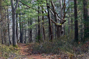
 Ellis Estate Trails: The 89 acres of woodlands surrounding the historic Bailey-Ellis House are home to a number of intersecting trails, plus Deke’s Pond. The Ellsberg Trail traverses wetlands and has some steep sections; the Seaview Loop is mostly level; the Bailey-Ellis Loop is mostly dry, but also occasionally steep. It’s a great place to see 100-year-old trees and glacial erratic boulders. On-site parking at 709 Country Way. https://www.nsrwa.org/listing/ellis-estate-trails/
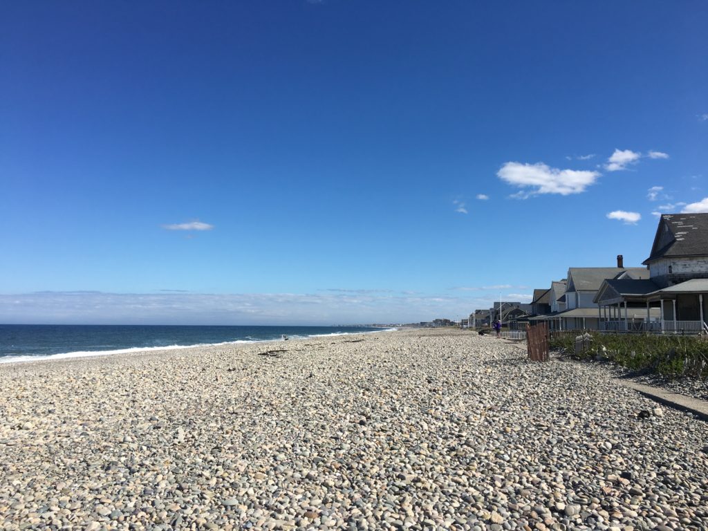 Humarock Beach: Let’s not forget Humarock! You can walk down the beach to Marshfield… or all the way up to the mouth of the North River at Fourth Cliff. With the wind and the waves and the tides, it’s a dynamic place — never boring. Limited parking on Marshfield Ave. plus a large lot for those with Scituate stickers. https://www.nsrwa.org/listing/humarock-beach/
Kezia Bacon’s articles appear courtesy of the North and South Rivers Watershed Association, a local non-profit organization devoted to protecting our waters. For membership information and a copy of their latest newsletter, contact NSRWA at (781) 659-8168 or visit www.nsrwa.org. You will also find 20+ years of Kezia’s Nature columns there.