
NATURE
by Kezia Bacon, Correspondent
The Massachuseuk tribe of indigenous people inhabited our region for thousands of years before European contact. Their territory extended along the coast from the North Shore to the South Shore, as well as 20 miles inland. More specific to our area, the Mattakeeset band of Massachuseuk established a village in what is now Pembroke, Hanson and Duxbury. There is still much to learn about their hunting, fishing, and agricultural practices, but it’s clear that they relied on our local waterways for both sustenance and travel.
European settlers began arriving on the South Shore in the 1620s. They too concentrated their activities along the rivers and the shoreline, before spreading out in all directions into the much-more-dense development we have today. While overall, the landscape has changed dramatically, there are still spots where it seems as if things haven’t changed all that much. When I go for walks in the woods, I love learning about its history. I find myself fascinated by what the property “used to” look like. This month’s article features walks at places with documented histories. At some of them, you’ll find interpretive signs that reveal past landscapes.
In addition to these walks, be sure to keep up with our 2022 Explore South Shore Challenge. Each week, we’ll suggest a different outdoor activity to try. This month it’s finding constellations and historic markers, plus winter walks and other winter fun. We’ll be featuring a relevant property every day in February on Instagram and Facebook. Are you up for a challenge? Post photos from your adventures to Instagram with the hashtag #ExploreSouthShore. Each month we randomly select a winner from the posts to receive a prize package.

Green’s Harbor Path and Kettle Hole Loop, Duxbury
Green’s Harbor Path was an approx. 13-mile road that extended from Plymouth, through Kingston, Duxbury and Marshfield. Originally defined by Native Americans, it became the primary north-south thoroughfare for our region’s European settlers as early as 1623. While most of it has been lost to modern roads and developments, a half-mile section of the original route has been preserved, within the Duck Hill River watershed. Look for the trailhead behind First Parish Church in Duxbury (842 Tremont Street). On-site parking.
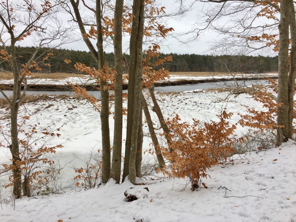
Webster’s Wilderness / Daniel Webster Estate, Marshfield
Wharf Creek, a tributary to the Green Harbor River, flows through the 130-acre Webster’s Wilderness, part of 1,200 acres that once belonged to US Senator and two-time Secretary of State Daniel Webster. A trail network leads past Cherry Hill, where Webster gave his last public speech, and then through lowland forest and wetlands. Right next door is Webster’s actual estate, with additional trails and historic markers. You’ll also find artifacts from the property’s agricultural history, and a section of the historic Pilgrim Trail. To go farther back in time, visit the Marshfield Airport, just across the river, where a museum-quality display chronicles Massachuseuk and Wampanoag artifacts found nearby. On-site parking (226 Webster Street).
Chapman’s Landing, Hanover
Adjacent to the Hanover Public Launch, you’ll find the trailhead for Chapman’s Landing. Once the westernmost shipping point in the North River system, this was the spot where the steamship Mattakeesett delivered iron ingots to be used in Hanover’s iron forges. Now it’s a lovely 50-acre woodland and wetland with gorgeous views of the Indian Head River. The property is located on the Indian Head River Trail, where interpretive signs shed some light on the Mattakeesett themselves. On-site parking (2 Indian Head Drive, Hanover).
Colby Phillips Trail, Hanover
This intriguing and diverse property offers 3 miles of trails through woods and freshwater wetlands, plus a bridge over Cushing Brook, part of the North River system. It is bordered directly by the tiny yet fascinating West Hanover Cemetery, where history enthusiasts will enjoy reading the gravestone inscriptions. You’ll find the trailhead on Whiting Street across from Hanover Middle School.
Stetson Meadows, Norwell
Although Native Americans likely inhabited this spot for centuries, in 1634, Cornet Robert Stetson was the first European to lay claim to 100 acres on the North River in this remote corner of Norwell. Stetson is remembered in posterity as part of the contingent that established the boundary between the Plymouth and Massachusetts Bay Colonies, and for negotiating the purchase of Abington and Hanover from the Narragansett. What was once his family farm is now 184 acres of conservation land with 2-3 miles of intersecting trails. On-site parking on Meadow Farm Way.
Old Rockland Fireworks Loop Trail, Rockland
Visiting Hanover’s grassy, spacious Forge Pond Park today, it’s hard to imagine the property’s industrial history. The Hanover Fireworks was located across the street, on the Drinkwater River, but deep within the park there’s another former-industrial area. Look for the metal gate at the western end of the Clark Bog Trail, and then follow the wide, partially-paved, Old Rockland Fireworks Loop Trail among crumbling concrete structures and drainage ditches, and see what images your curious mind conjures! Ample parking in Forge Pond Park. Additional access via Satucket Road in Rockland.
Bare Cove Park, Hingham
This 484-acre property on the banks of the Back River offers 5 miles of paved and woodland trails through wetlands, woodlands, open fields, and marshes. Prior to, and concurrent with, European settlement, the Massachuseuk maintained encampments here. More recently, it was the home of the Hingham Naval Ammunition Depot. At its peak during World War II, there were 90 buildings and 15 cranes, employing over 2,400 civilians and military personnel. Remains of old wharves are plainly visible from some of the trails that extend along the edge of the marsh and river. The military base was decommissioned in 1961, and turned over to the Town of Hingham in 1971. Ample on-site parking on Fort Hill Street.
Great Esker Park, Weymouth
Directly across the river from Bare Cove is another former military site. Archaeological studies indicate that this forest-covered esker ridge along the Back River was inhabited by indigenous people as early as 7,000 B.C. In the early 20th century, it was preserved by the U.S. government as a buffer for the Naval Ammunition Depot across the river. Military patrols made use of the high vantage points along the ridge to guard the base below. It was sold to the Town of Weymouth in 1965. Now there are more than 6 miles of paved and unpaved trails, with extraordinary estuary views. Ample on-site parking (7 Elva Road).
Webb Memorial State Park, Weymouth
The Massachuseuk used this grassy peninsula between Weymouth’s Back and Fore Rivers for seasonal encampments. Today, its flat, undemanding walking trails offer numerous serene water and skyline views. But its history isn’t quite so serene! In 1775, the Grape Island Alarm took place just off shore — a skirmish between colonists and British ships that was only the second armed confrontation of the American Revolution. Next came many years of agricultural and industrial use, and then in the late 1950s, the property became home to a Nike anti-aircraft missile launcher (one of 12 in the Boston metropolitan area). In 1980, after deactivation and major clean-up, it became a park. Ample on-site parking (361 River Street).
Union Point Northern Gateway, Weymouth
The 2 miles of trails at this decommissioned Navy property are not the most user-friendly, but who knows what the adventurous explorer might stumble upon? Start by following the path away from the Southfield Dog Park, toward the woods. You’ll see the remains of former military buildings and structures, and perhaps even an empty bunker or two! During World War II, blimp combat patrols were based here. In later years, it served as an air station, research facility, and training base. The property is located within the Back River watershed. Limited parking at the Southfield Dog Park (25 Memorial Grove Ave.)
Kezia Bacon’s articles appear courtesy of the North and South Rivers Watershed Association, a local non-profit organization devoted to protecting our waters. For membership information and a copy of their latest newsletter, contact NSRWA at (781) 659-8168 or visit www.nsrwa.org. You will also find 25+ years of Kezia’s Nature columns there. Click here for more information about the 2022 Explore South Shore Challenge. This article is Powered by Planet Subaru.