
NATURE
by Kezia Bacon, Correspondent
This month the North and South Rivers Watershed Association is featuring the town of Duxbury in its 50 Places to Explore contest. During this prolonged time of social distancing, we encourage the public to visit conservation lands and other open space areas. While a few of my favorite properties are presently closed or restricted due to the coronavirus pandemic, there are still plenty I can recommend. Click here to learn how to visit parks during Covid-19 safely and responsibly.
Click here to find out where to get your FREE Guide Map.
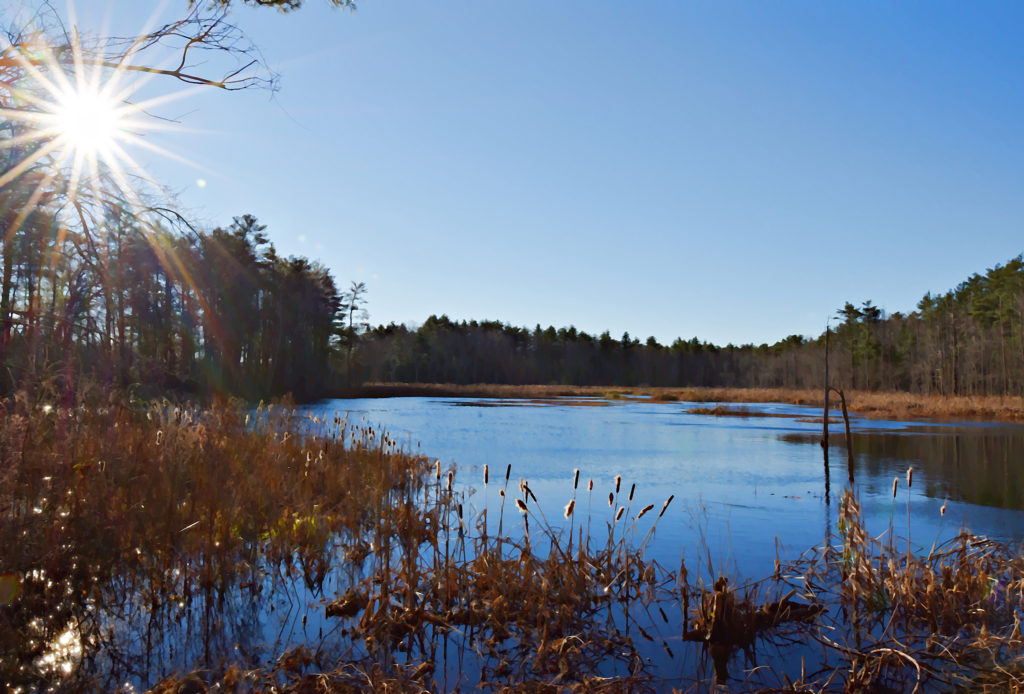
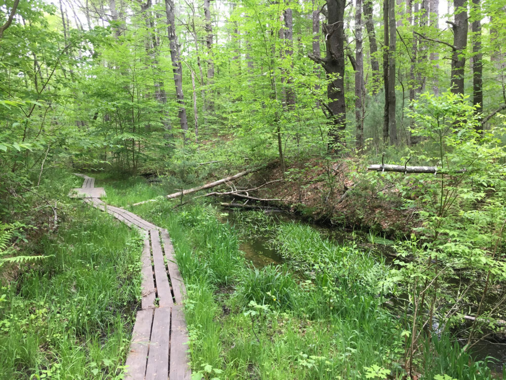 Lansing Bennett Forest
You may know this 344-acre Duxbury Conservation parcel as Trout Farm. It was given a new name to honor the late Dr. Lansing Bennett, who served as chair of the Conservation Commission for 10 years and helped to develop a greenbelt plan for the town. In earlier days, it was the site of a box mill and later a trout farm. Phillips Brook, a tributary to the South River, flows through the eastern side of the property. There are several intersecting trails through the woods, some with steep sections, plus occasional boardwalks and footbridges. Limited roadside parking on Union Bridge Road.
Visit: https://www.nsrwa.org/listing/lansing-bennett-forest/
 Thaddeus Chandler Sanctuary
This 114-acre Duxbury Conservation woodland was a recent and happy discovery for me. It offers about 3 miles of blazed, well-maintained trails through the woods and wetlands bordering Pine Brook and Upper Chandler Pond. The lands within were once developed as cranberry bogs. A number of manmade irrigation channels are still present, but the bog areas have become considerably wooded after years of disuse. I especially enjoyed the mossy areas along the yellow trail. Limited roadside parking on Valley Street.
Visit https://www.nsrwa.org/listing/thaddeus-chandler-sanctuary/
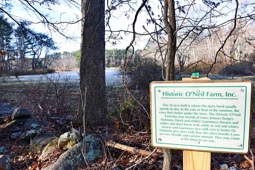 Historic O’Neil Farm
Visit the only working dairy farm in Duxbury! The 145-acre property, established as a nonprofit in 2005, has been in continuous agricultural use since the early 1700s. It offers 1.75 miles of trails through woods, wetlands and pasture. Interpretive signs provide information on the cows, wildlife, and other agricultural features. Small parking lot at 146 Winter Street. Visit: https://www.nsrwa.org/listing/historic-oneil-farm/
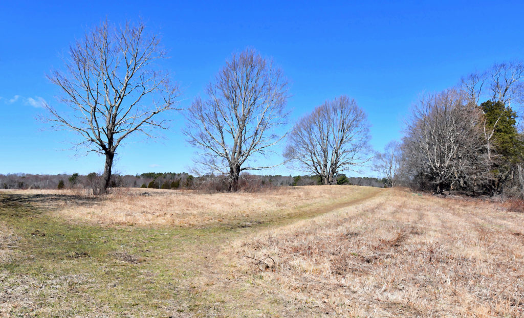
 Whiton Woods
This 32-acre Duxbury Conservation parcel features a network of intersecting cart paths and footpaths. It is mostly pine forest, but there are also old stone walls, bubbling streams, large outcroppings of rocks, swampy lowlands, even a vernal pool or two. There is no official trail map, so visiting Whiton Woods requires a bit of guesswork. However the trails are well-established, and they are blazed either with paint or with plastic markers. A short walk around the blue trail loop might take 20 minutes. One could easily spend an hour investigating various spur trails. Limited roadside parking on Temple Street.
Visit: https://www.nsrwa.org/listing/whiton-woods/
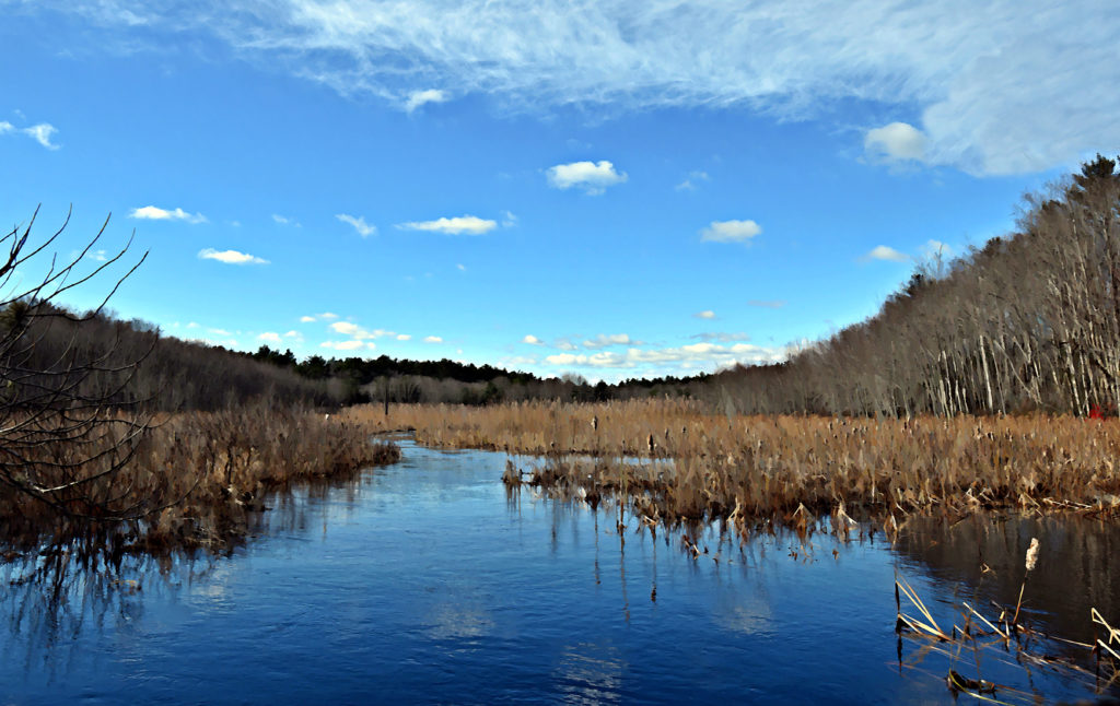
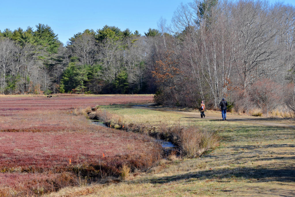 Duxbury Bogs
This 230-acre Duxbury Conservation property features active cranberry bogs, wetlands, reservoirs, and forested upland, with an expansive trail network. There are about 3 miles of trails. These are primarily wide dirt roads, but there are also some narrower woodland paths along the edge of Cranberry Factory Pond as well as the large pond known as the Sunken Forest, or Golden Reservoir. With a variety of habitats, the Duxbury Bogs attract all sorts of wildlife, especially birds. Limited on-site parking on East Street. Visit: https://www.nsrwa.org/listing/duxbury-bogs/
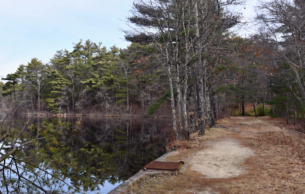
 Bay Farm
This former dairy farm is now a popular walking spot, with a varied 2-mile trail network and spectacular views of Kingston Bay. Some trails lead through the woods, others around and through a large open meadow, and others along the bay shore. All are color-coded, with corresponding maps available online. Don’t miss the large grove of cedar trees on the yellow trail. The 80-acre property is owned jointly by the towns of Duxbury and Kingston. Limited on-site parking on Landing Road. Visit https://www.nsrwa.org/listing/bay-farm/
 Green’s Harbor Path, Kettle Hole Loop and Knapp Town Forest
Green’s Harbor Path and Kettle Hole Loop are relatively new woodland trails, part of Duxbury’s 1,000-acre Eastern Greenbelt. Located within the 823-acre Frederick B. Knapp Town Forest, they combine to form a 2-mile loop around the rim of a kettle hole. Green’s Harbor Path follows the course of a pre-Colonial roadway. Look for the kiosk and trailhead behind First Parish Church in Duxbury. Also nearby, the Knapp Trail, blazed in yellow, leads into the property from the intersection of Harrison and Tremont Streets, runs concurrent with much of the Kettle Hole Loop trail, and then continues through the O’Brien Bog and into the Knapp Town Forest. Limited on-site parking at 842 Tremont Street. Additional access and parking on Mayflower Street. Visit https://www.nsrwa.org/listing/greens-harbor-path-and-kettle-hole-loop/ and https://www.nsrwa.org/listing/frederick-b-knapp-town-forest/
 Crowell Conservation Area
Birders will especially enjoy this 60-acre Duxbury Conservation property. Formerly a cranberry bog, it is slowly transitioning back to its natural state. It offers about a mile of wide trails around marsh, ponds, and wetlands. Limited on-site parking on Lincoln Street.
Visit https://www.nsrwa.org/listing/crowell-conservation-area/
 Camp Wing Conservation Area
The South River and its tributary, Phillips Brook, flow through this 450-acre Duxbury Conservation property. Much of Camp Wing is maintained as wilderness for water protection and wildlife habitat, but there are walking trails in two sections. From the parking area on Franklin Street, there is a large color-coded loop system, leading through forested upland and red maple swamp. On the red trail, be sure to check out the observation deck, which overlooks fen and marsh areas. Another trail, known as the John Rubin Path, is located in a non-contiguous section of the property, off Temple Street. You’ll find the trailhead across the street from Keene’s Sawmill. It leads for a mile through the woods and around a loop that offers views of the South River.
Visit https://www.nsrwa.org/listing/camp-wing-conservation-area/
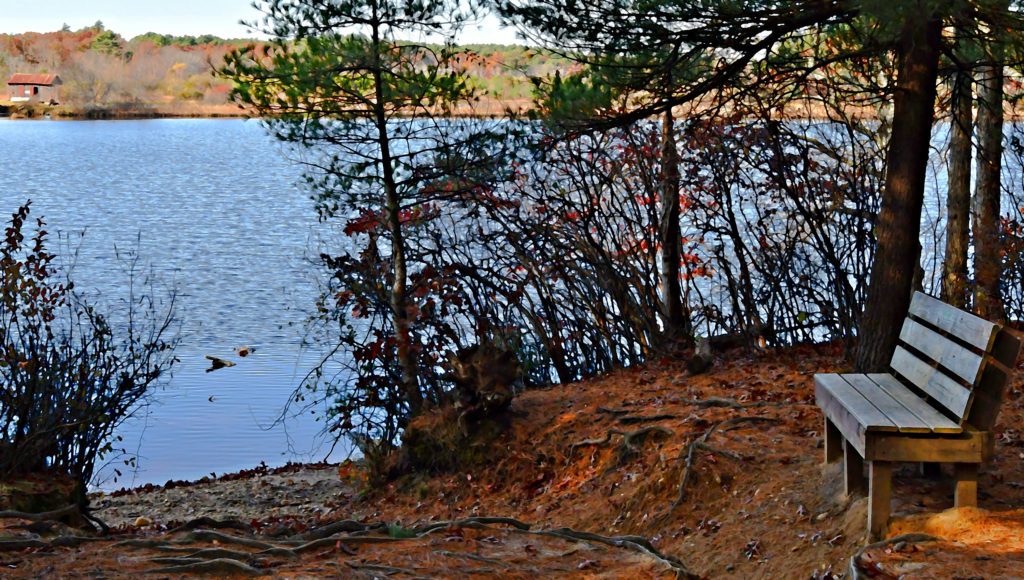 Round Pond Conservation Area and Cherry Lane Bogs
Round Pond is much more than just a pond. The property’s namesake – a 10,000-year old kettle hole — lies at its center. Pine and oak woods surround the pond, and contain a number of intersecting, well-marked trails, some of which traverse wetlands via boardwalk. There are other surface waters nearby too – active cranberry bogs and reservoirs, other ponds, and even a small lake. Altogether they comprise about 177 acres of town-owned conservation land. Limited on-site parking on Mayflower Street.
Visit https://www.nsrwa.org/listing/round-pond-trails/ and https://www.nsrwa.org/listing/cherry-lane-bogs/
 South River Bog
This 100-acre Duxbury Conservation property, formerly known as Feinberg Bog, was once cranberry bogs, but its agricultural days have passed. Dormant since the early 1900s, it has slowly converted to forest and marsh. The South River runs through it, plus several of the bog’s old irrigation channels are still in place. Looking out over the water, you may wonder what you’re seeing: the not-so-distant traffic of Route 3 is surprisingly close-by. There is a network of blazed trails on site, totaling about 1 mile. Look for beaver dams across the smaller streams. Limited roadside parking at 198 North Street. Visit https://www.nsrwa.org/listing/south-river-bog/
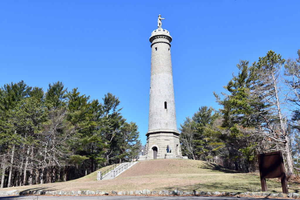 Myles Standish Monument State Reservation
Climb to the top of Captain’s Hill for a panoramic view up and down the coast. Situated 200 feet above sea level, the monument itself is a 116-foot-tall granite shaft topped with a 14-foot statue of Captain Myles Standish, military leader of Plymouth Colony. The tower is open seasonally, on weekends, but you can hike up the hill anytime, using the paved access road, or either of two woodland trails. The 28-acre property is owned by the Massachusetts Department of Conservation and Recreation. When the tower is open, visitors can climb 125 steps to a small viewing area at the top. The access road is located on Crescent Street. When the gate is open, there is abundant parking near the top of the hill. Visit https://www.nsrwa.org/listing/myles-standish-monument-state-reservation/
Kezia Bacon’s articles appear courtesy of the North and South Rivers Watershed Association, a local non-profit organization devoted to protecting our waters. For membership information and a copy of their latest newsletter, contact NSRWA at (781) 659-8168 or visit www.nsrwa.org. You will also find 20+ years of Kezia’s Nature columns there. For more information about the 50 Places to Explore Contest,” visit https://www.nsrwa.org/get-outdoors/enter-the-nsrwa-50-places-to-explore-contest/